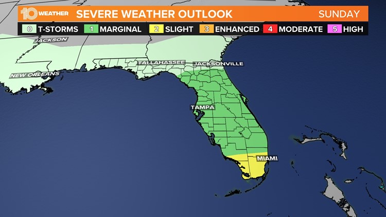
ST. PETERSBURG, Fla. — The Storm Prediction Center has outlined much of the Florida peninsula, including all of the Tampa Bay area, under a marginal risk for severe weather on Sunday. That's a level one out of five, meaning that isolated severe storms are possible.
A developing system is forecast to swing into the state, bringing rounds of showers and storms. Although many ingredients will be in place for some stronger activity, we'll be missing a key factor — an unstable atmosphere. Right now, it looks like the higher risk will remain in South Florida and the Keys.
If there are fewer morning showers and cloud cover, allowing some sun to peek through and heat the environment, some storms could be on the stronger side.
You'll want to download the 10 Tampa Bay app for the latest forecast and severe weather alerts.


The active weather pattern remains in place on Monday, with more showers and storms from time to time. As of this writing, there's less of a severe weather threat.
A trailing cold front sweeps through the region late Monday into Tuesday. That'll cause our winds to ramp up for some time but also usher in some improving conditions by midweek.