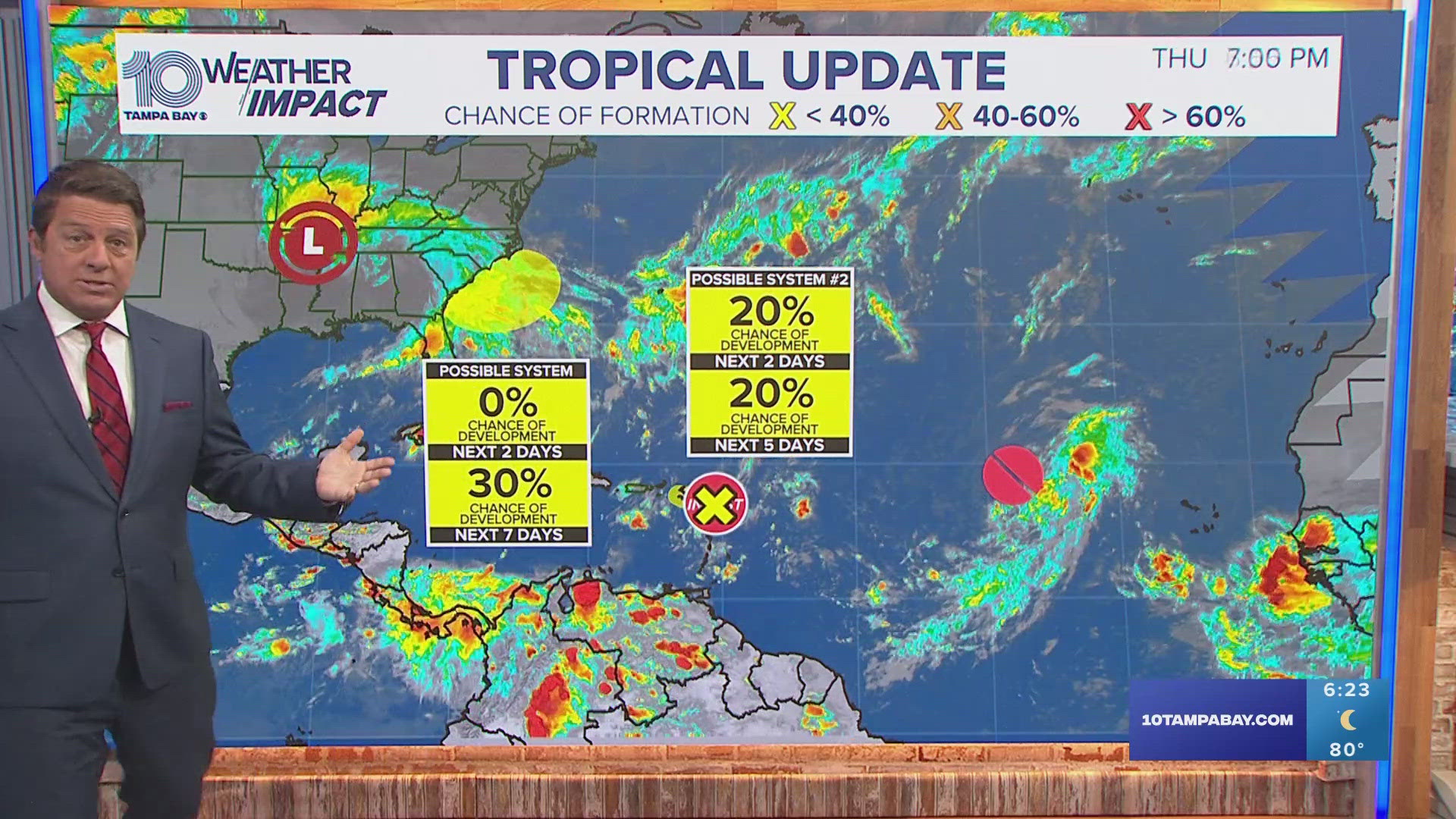
A strong cold front will bring the potential for severe thunderstorms to our region, especially in the Nature Coast late Thursday into Friday.
While there is still uncertainty on the timing and precise location of the strongest storms, storms will be capable of producing strong, gusty winds, locally heavy rain and frequent deadly lightning strikes.
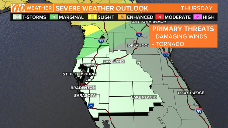
TIMING: The most likely timing for storms Thursday will be overnight, after 2 a.m. The storm chances will continue through Friday.
CONCERN: Damaging wind will be the biggest concern where severe storms develop. An isolated tornado can’t be ruled out, especially along the Nature Coast.
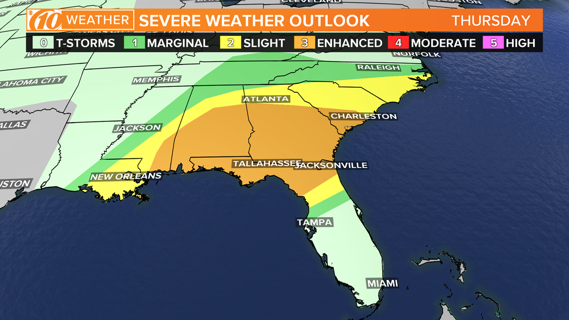
WHERE: Most of Tampa Bay will be on the southern fringe of this severe storm risk, while the Nature Coast will see a higher risk.The greatest risk for severe weather will be in Louisiana, Mississippi, Alabama, Georgia and north Florida, where strong tornadoes will be possible during throughout the day Thursday.
The cold front eventually stalls over Florida, keeping rain and storm chances in the forecast through the weekend.

if our region gets severe weather, it will come on the heals of dangerous conditions that caused damage earlier this week.
- Florida is getting ready to re-open. Here's who's on the task force
- Tom Brady and Rob Gronkowski will reunite in Tampa Bay
- 'Not so fast': Epidemiologists hesitant to say Florida has flattened the curve
- SOLVED: Source of coronavirus exposure discovered for NC woman who hadn't left her house in weeks
- In COVID-19 fight, an ‘arsenal’ of treatments being studied in Tampa
- Wendy's is giving away free chicken nuggets
- Hotlines, websites offer the latest on COVID-19
FREE 10NEWS APP:


►Stay In the Know! Sign up now for the Brightside Blend Newsletter