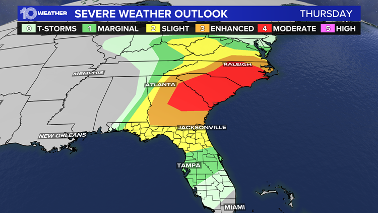
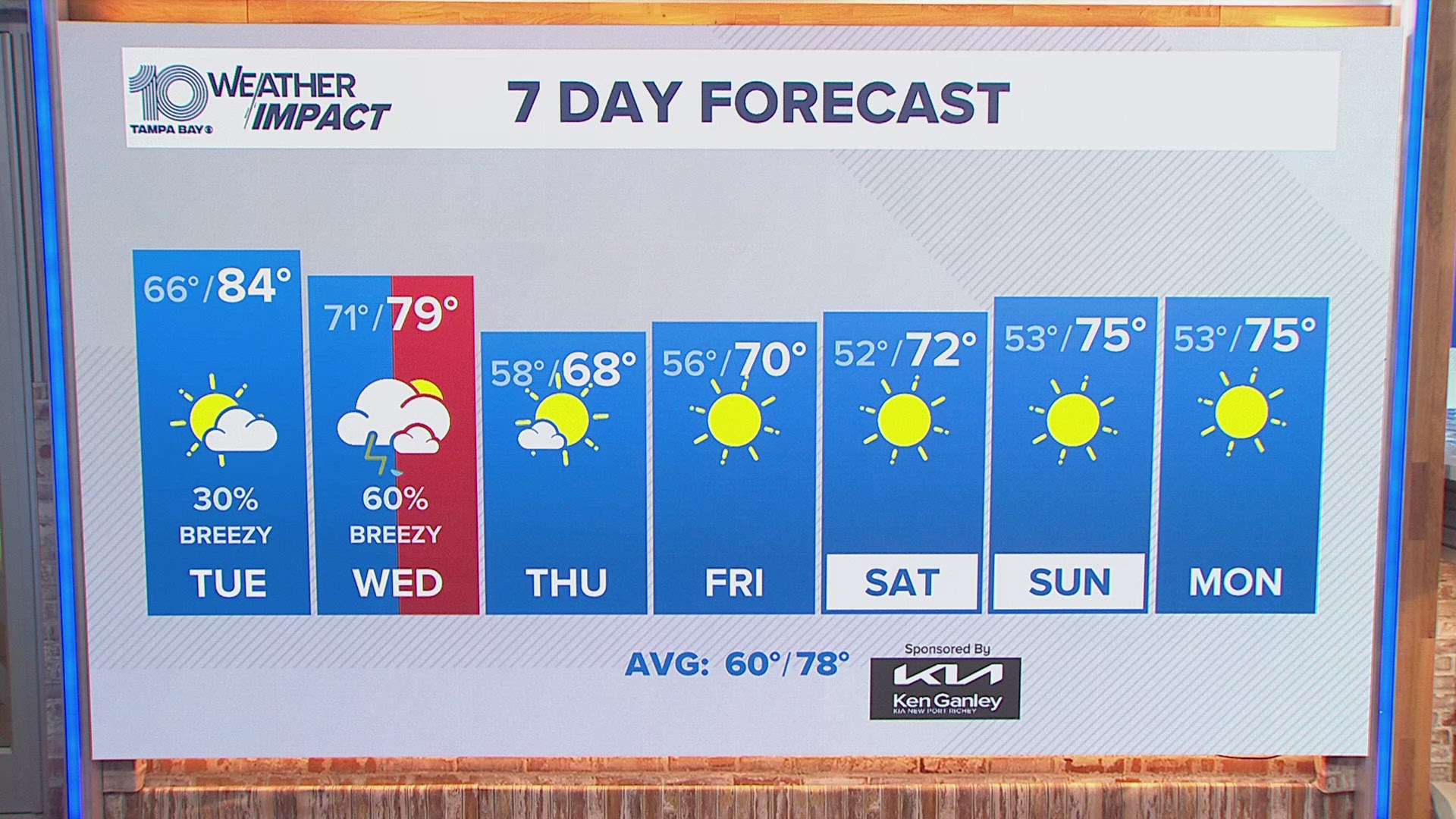
A cold front will move into the Florida panhandle Thursday, bringing Florida’s best chances of rain and storms. By Thursday evening, those chances will move into the Tampa Bay area.
At this point, any rain chances in our forecast area should hold off until the second half of Thursday, and this will be confined to the Nature Coast late in the afternoon and early evening.
It is unlikely that any rain or storms reach the I-4 corridor and southward until sunset or beyond. South of I-4 will be more likely to see showers and thunderstorms in the evening, perhaps after 9 p.m.
The line of showers and storms that develops will likely become more disorganized as it progresses south of Tampa Bay during the overnight hours on Thursday night.
Certainly, the best potential for more widespread rain will be from the I-4 corridor northward; but even there, the rainfall amounts are expected to be light.
Any storms that develop, could be strong-to-severe. The Storm Prediction Center (SPC) has put Tampa Bay in a "marginal" risk for severe weather. The SPC ranks storm risk on a 1-5 risk level.
1 - MARGINAL: A Marginal Risk means storms are not expected to be widespread. They are typically limited in duration and/or intensity. Even though this threat level is on the low end, you should still take it seriously as tornadoes, damaging wind, and large hail are all possible.
2 - SLIGHT: A Slight Risk means scattered strong thunderstorms are expected. Again, these storms may be short-lived, but they can be intense. Storms can produce tornadoes as well as isolated areas of wind or hail damage.
3 - ENHANCED: An Enhanced Risk means numerous severe storms are expected. The storms will be more widespread than the previous threat levels. Again hail, wind damage, and tornadoes are all possible.
4 - MODERATE: A Moderate Risk means severe thunderstorms are likely to be more widespread. They may also be longer-lived storms, and even more intense than the first three risk levels. There is more concern for strong or long-lived tornadoes, and extensive wind or hail damage.
5 - HIGH: A High Risk is pretty rare, especially in Tampa Bay. This is the most severe risk level. Strong, long-track tornadoes, widespread wind damage or extremely large and damaging hail are possible. Catastrophic damage is possible.
A severe thunderstorm is defined by the National Weather Service as one with measured wind gusts at least 58 miles per hour, hail at least one inch in diameter, and/or a tornado.
- Boat procession will honor 3 Tampa Bay area officers killed in the line of duty this year
- Remembering fallen Officer Jesse Madsen: Police officer, Marine, soldier, husband and father
- What we know about fallen Tampa Police Officer Jesse Madsen's funeral
- Doctors warn against dropping social measures before vaccines are more widely available
- Former NFL star Keyshawn Johnson mourns death of daughter Maia
►Breaking news and weather alerts: Get the free 10 Tampa Bay app
►Stay In the Know! Sign up now for the Brightside Blend Newsletter


