
TAMPA, Fla. — Plumes of Saharan dust traveling across the Atlantic basin from the coast of Africa are not uncommon for this time of year, but how do they affect weather across Tampa Bay?
We spoke with 10 Tampa Bay Meteorologists Colleen Campbell and Natalie Ferrari about the dust and how it impacts our region.
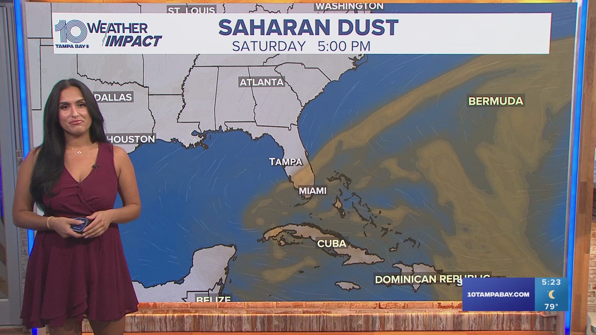
"These dust plumes, also known as the Saharan Air Layer (SAL), can bring a multitude of impacts to the Tampa Bay area: stunning sunsets and sunrises, as well as some impacts to air quality, but most notably, the Saharan dust suppresses tropical development," our 10 Tampa Bay weather team said.
Here's everything you need to know about the Saharan dust this summer:
What are Saharan dust plumes?
Saharan dust plumes, or the Saharan Air Layer (SAL), come from the coast of Africa. A plume can form when tropical trade winds pick up dust and lift it into the atmosphere. Plumes usually leave Africa every three to five days between late June and early August. They are typical for this time of year, according to the National Environmental Satellite, Data and Information Service.
The dust is carried westward in the area between the coast of Africa and the Caribbean, known as the tropics. NESDIS reports that the SAL usually occupies a 2 to 2.5-mile-thick layer of the atmosphere, beginning about 1 mile above the surface.
Sunrises and sunsets
The vibrant orange and pink sunrises and sunsets that are often attributed to Saharan dust typically happen when the dust shows up in thin, sparse layers.
In the thick of the plume, the sky becomes more hazy in the evenings and may appear a light orange with an opaque look. During the day, the sky may look light blue or even a milky white.
However, while the plumes are coming and going, that's when those iconic colors pop. The thin layers of Saharan dust interact with chemicals and gases in the atmosphere, creating magnificent orange and red colors.
RELATED: Saharan dust prompts air pollution precautionary advisory for Pinellas, Hillsborough counties
Air quality
The dust increases the amount of PM2.5, or particles that are smaller than 2.5 micrometers. For reference, a single human hair averages between 50 and 70 micrometers thick.
In small quantities, the dust is not harmful to the human body. It is, however, able to pass through the body's natural filters and enter the lungs. Those with preexisting respiratory issues can be sensitive to any quantity of Saharan dust in the air, according to Dr. Tim Connolly, a pulmonologist at Houston Methodist.
However, Connolly does say that anyone can feel the effects of plumes, especially when they hang over the area, which can sometimes be for one to two weeks. He says wearing a cloth face mask can help reduce some of the effects of the Saharan dust.
Tropics and hurricanes
Meteorologists and weather organizations often attribute a "dry" tropical season to Saharan dust, but it isn't because it absorbs the moisture.
A large SAL creates an albedo effect, meaning the sunlight hitting the plumes will be reflected, resulting in cooler water temperatures underneath and higher wind speeds.
Hurricanes and tropical disturbances need near-perfect conditions to form: warm water and calm winds.
The Saharan plumes often cover the water enough to lower the temperatures to under 80 degrees Fahrenheit, the temperature required to form a hurricane. The wind sheer picks up as the dust moves and creates a lower moisture content over the tropics.
"While Saharan dust can help limit development in the tropical Atlantic this time of year, that trend does not last for long. As we enter the peak of hurricane season through August, September, and October, conditions turn very prime for tropical development" our 10 Tampa Bay weather team says.