
ST. PETERSBURG, Fla. — It happens every year and this year, it’s happening a little sooner than normal. Large plumes of dust originating more than 4,000 miles away in the Sahara Desert get caught up in the trade winds and make their way across the Atlantic into the Caribbean and Gulf of Mexico.
An area of very dry and dusty air forms over the Sahara Desert during late spring when these large plumes of Saharan dust begin to make their way across the Atlantic.
Typically, this activity begins to ramp up in mid-late June, but the Saharan Dust party has gotten started a little sooner this year.
The first big plume
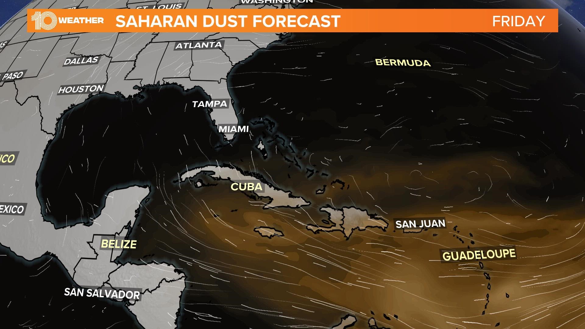
The first big plume of Saharan dust has already made its way into the Caribbean and will begin to move north of Cuba and into the southern Gulf of Mexico on Friday. From there the plume of dust will spread over Florida and over much of the Gulf of Mexico, including as far west as Texas by Monday.
Even into Tuesday, it looks like the dust plume could hang around potentially impacting the weather forecast as well as the overall appearance of the skies in Tampa Bay.
Typically, when plumes of Saharan dust move overhead, they produce hazy or dusty skies during the day and potentially more vibrant sunrises and sunsets. The added dusty to the early-morning and evening skies the sunlight to be scattered more which produces more red, orange, and pink hues.
Too much dust, however, can simply make the sunrises and sunsets duller and less spectacular.
Dust and tropical moisture
Along with this plume of dust, a surge of tropical moisture is pushing in from the south Friday and into the weekend. The increase in moisture will bring an increased threat of showers and storms, however, the arrival of the Saharan Dust may work to limit the intensity of the rainfall.
Initially, widespread showers and storms will precede the arrival of the plume of dust on Friday, but by Saturday and Sunday, the rain could be less widespread and intense depending on how much of the dust plume actually moves overhead.
More dust plumes on the way
This will likely be the first of several plumes of Saharan dust that make their way across the Atlantic this year. During the peak Saharan dust season from late June to mid-August, the plumes of dust typically emerge from the coast of Africa every three to five days.
Not all plumes, however, are robust enough to make their way all the way to the United States.
While the majority of the dust associated with these plumes is concentrated well above the ground, sometimes the dusty particles can reach down to the surface. In these situations, air quality will be reduced potentially posing a threat to those with respiratory issues. It’s important to stay aware of the air quality on days when these Saharan dust plumes move into the area.
Symptoms that you might experience may be similar to those resembling allergies, such as scratchy throat, itchy eyes, sneezing or coughing.
Warm and dry air is also associated with these plumes of Saharan dust and often times areas experience their hottest days of the year when these plumes are present. In addition to the potential for poor air quality, it’s also important to be mindful of the dangers of excessive heat, especially through the middle of the afternoon.