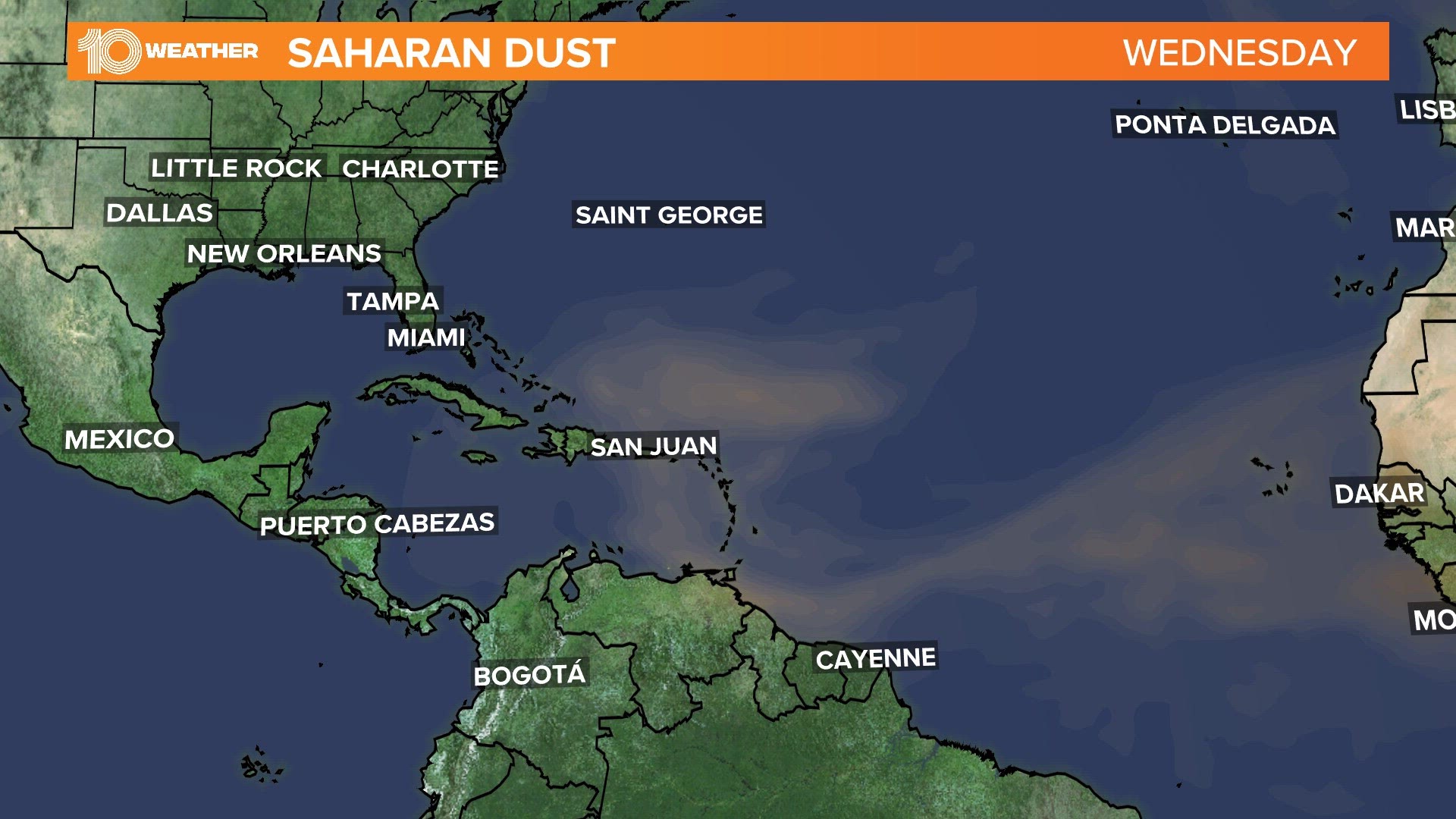
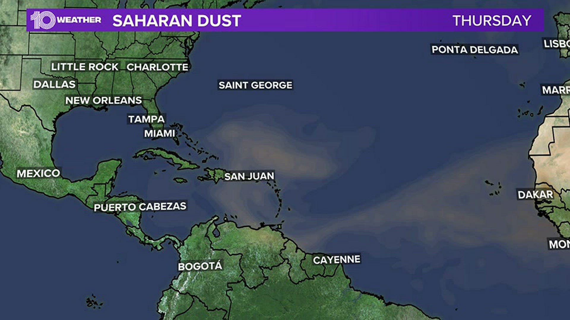
ST. PETERSBURG, Fla. — It's around that time of year when the region gets a visit from the Saharan dust — but it hasn't reached us yet.
A plume of dry and dusty air has been traveling thousands of miles west of Africa and it's already creeping in on the Gulf of Mexico. And right now, the Saharan Air Layer (SAL) continues to smother Puerto Rico.
SAL is a dry and dusty air mass that forms in the Saharan Desert in northern Africa. In late spring and early summer, trade winds pick up this mass of dusty air and carry it nearly 4,000 miles from its origin across the tropical Atlantic and can reach as far west as Texas.
The dust particles actually hold in heat, much like clouds do here in Florida, and as the sun does its job by heating everything up, the clouds and dust act like blankets and don't allow the heat to escape.
Because of this, Puerto Rico is feeling the heat, with heat indices reaching upwards of 100 degrees. Because of this Puerto Rico once again will see dangerous heat with excessive heat warnings today for the extreme northern coast. The real-feel temperatures will be near 110-115.
"Drier air and Saharan dust will gradually move over the region during the next few days, but the combination of high temperatures and available moisture could yield heat indices of 102 degrees or higher each day," NWS said in a tweet.
Not only does the Saharan dust create that blanket effect to trap heat, but it also makes it harder for thunderstorms to form and help cool things down. That's because thunderstorms need cooler air aloft and rising in order to form.
With that dust, San Juan is expected to see very hot conditions for the rest of the week. Skies in the area will also be hazy due to the Saharan dust. It's expected to diminish through the end of the week with rainfall in the forecast coming next week.
The hazy skies from the Saharan dust can make for brilliant sunrises and sunsets. However, the amount of dust could affect people who have respiratory ailments, making it harder to breathe at times.
The good news is this dust does not mix well with tropical cyclones or tropical waves, meaning it could temporarily keep things quiet in the tropics.
So what does this mean for Florida?
At this time, the state is in the clear of the Saharan dust. However, if it does reach the Sunshine State, the dust is usually benign and is overall nothing to be concerned about. In fact, SAL has a few beneficial properties, especially during the early months of hurricane season.
SAL's dry air and strong winds can help inhibit tropical cyclone development and/or intensification, at least temporarily. Saharan dust can also help to suppress storm activity locally. The dust “caps” the lower atmosphere, limiting thunderstorm growth. We tend to cut back on a few of those sea breeze-driven afternoon downpours when dry Saharan dust is present.
But we are likely to experience a few dust plumes with our peak SAL season between late June and early August. Our weather team will keep you informed, prepared and connected on the Saharan dust throughout our hurricane season.
Meteorologist Autumn Robinson contributed to this report.


