
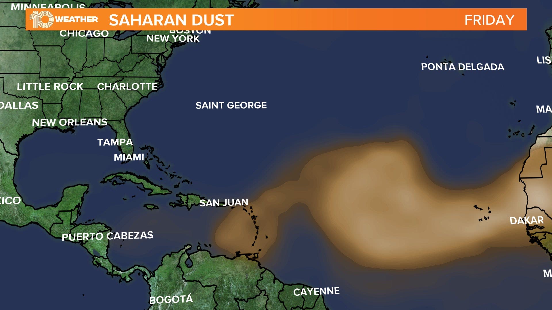
ST. PETERSBURG, Fla. — A massive dust storm is blowing westward off the Sahara Desert in Africa and is moving over the Atlantic Ocean toward Florida.
These storms aren’t uncommon. This is the time of year we see strong easterly winds streaking toward the Caribbean.
Our weather models keep the tropics pretty quiet during the next week over the Atlantic, and this dust is part of the reason why.
It’s known as the Saharan Air Layer (SAL) and it can be a real inhibitor in the development of tropical cyclones. The SAL is about 50 percent drier than tropical air. It is also associated with strong winds of up to 55 mph, which can increase vertical wind shear.
Since tropical cyclones need moist air and low wind shear, this dust can be a real problem for tropical storms and hurricanes to develop.
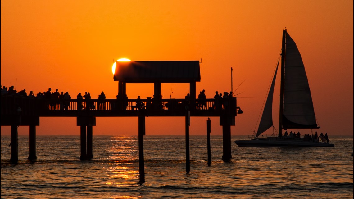
Not only do the dust storms help inhibit tropical cyclone development, but they can also bring spectacular sunsets across Florida and the Caribbean. This is due to the particles of dust in the sky. The light refracts more at sunset and this will give off a deep red or orange color to the sky.
As long as we have dry evenings, we’ll be able to see the dust high up in the atmosphere. If we have rain, the precipitation will cleanse the air and the dust will be washed away.
So, get those cameras ready and be on the lookout for some beautiful sunsets next week!

- DeSantis, citing increased testing as COVID-19 cases climb, says no changes for Florida's reopening
- Florida reports another 2,610 new COVID-19 cases, slightly lower than record
- Man arrested, accused of pushing 92-year-old woman to the ground
- Florida bridge at 'risk of imminent collapse,' Coast Guard warns
- $4,000 travel tax credit could be waiting for you in next stimulus
- Florida sees highest number of COVID-19 cases yet: 2,783 in one day
- Bucs release first photos of Tom Brady in team uniform