TAMPA, Fla. — More dust from the Saharan Desert is making its way across the Atlantic this weekend, and it is keeping the tropics quiet, for now.
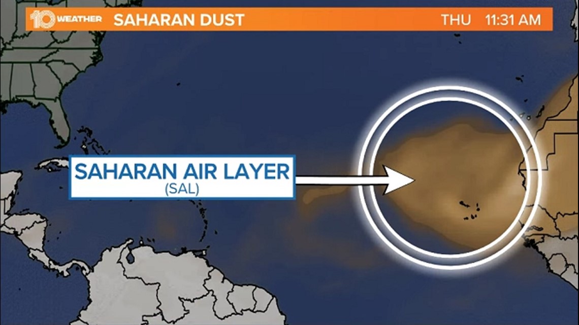
The Saharan Air Layer, or SAL, is dry and dusty air mass that forms in the Saharan Desert in northern Africa. During the spring and summer months, trade winds pick up the dusty air and can carry it more than 3,500 miles across the tropical Atlantic.
From late July through mid-August, SAL activity ramps up, and the dust can easily be spotted on satellites as it brings an orange haze to the skies of the Caribbean.

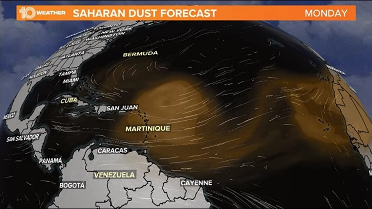
Plumes of dust have traveled as far as Texas already this year, and another round of it is moving off of the African coast this week.
By Monday, a dense area of Saharan Air Layer dust is expected to move over the Windward Islands in the Caribbean before some of that dust makes it closer to the Gulf of Mexico by midweek.
Saharan dust and tropical systems do not mix. The thick dust can help to cool sea surface temperatures down slightly, and the dry air and strong winds can help inhibit tropical cyclone development and/or intensification, at least temporarily.


When tropical systems ingest dry air and encounter wind shear, they tend to struggle and lose their structure. These dry, strong winds associated with the SAL reduce the moisture needed for tropical storms and hurricanes to form, which can limit their organization.
Saharan dust can also help to suppress storm activity locally when it journeys to the Florida skies. The dry dust can “cap” the lower atmosphere, which can limit thunderstorm growth during the rainy season.