ST. PETERSBURG, Fla. — The 10Weather team is tracking a strong storm system bringing the threat for severe storms across the Southeast Thursday into Friday. Brightside Meteorologist Grant Gilmore broke down the specific details of the forecast as the threat for storms moves toward Tampa Bay.
Summary:
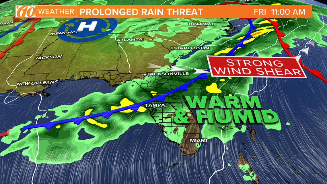
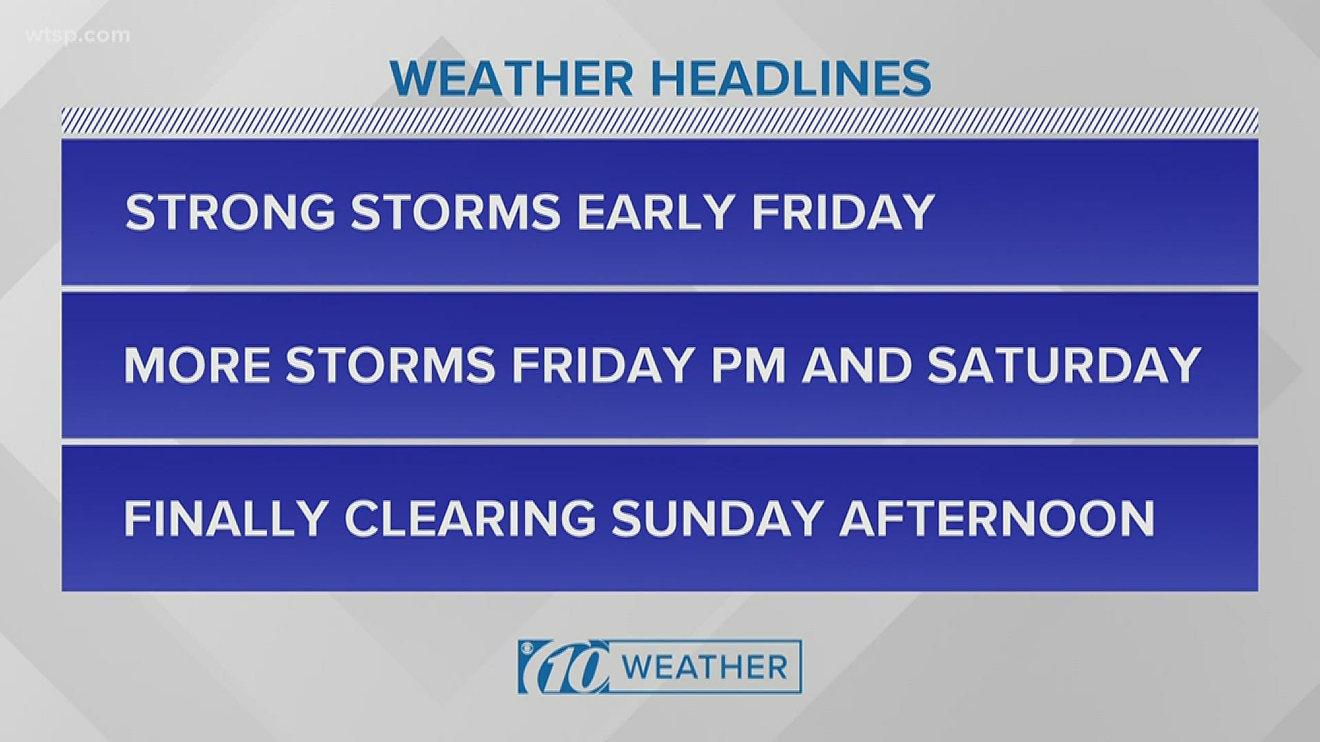
A strong storm system over the Southeast will continue to produce the threat for severe weather today in southern Alabama, southern Georgia, the Florida Panhandle and northern Florida. The cold front with this system will drop into Central Florida over the next day or so producing the chance of multiple rounds of showers and storms to Tampa Bay beginning Friday morning and through much of the weekend. Some of the storms Friday and Saturday could be strong or severe.
Where:
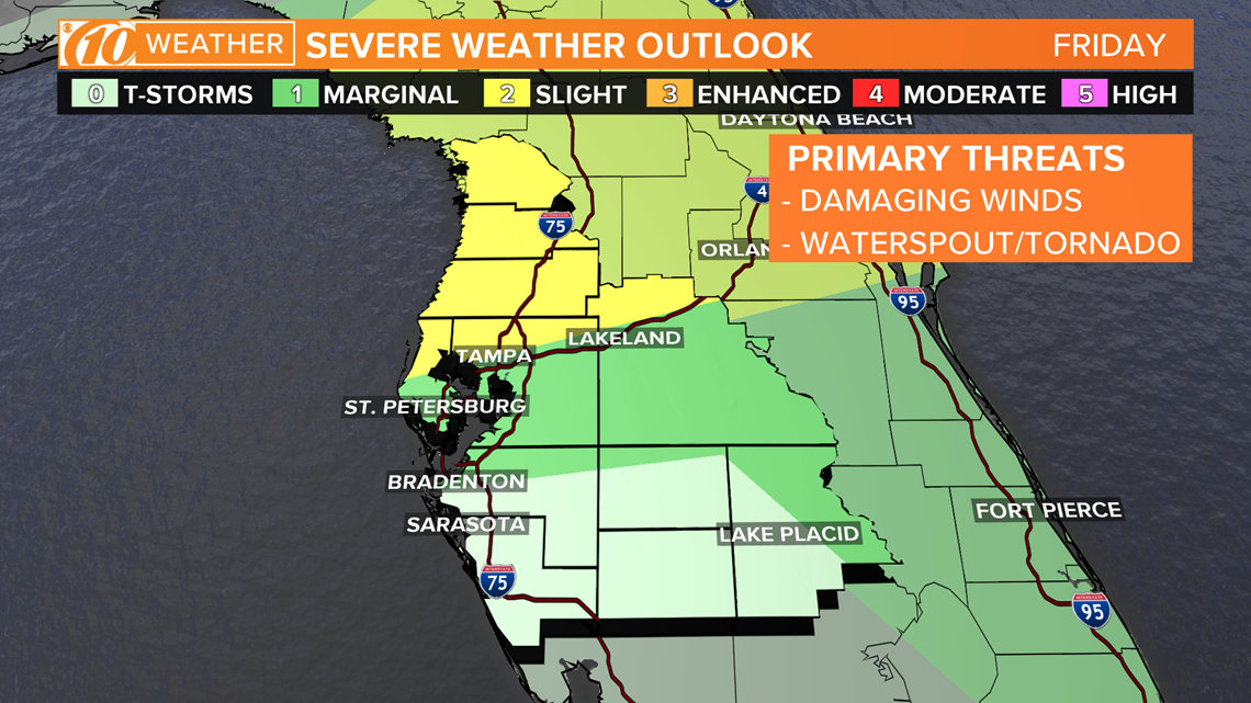
The greatest threat of severe weather will be along and north of the I-4 corridor. There's a chance for a few rounds of severe storms in this area. This includes Hillsborough, Pinellas and Polk counties.


When:
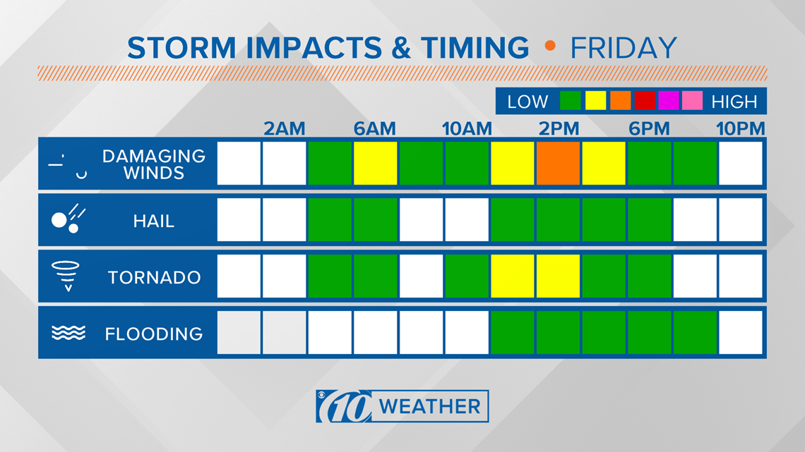
There will be multiple rounds of storms. The first round may arrive through early Friday between 3-7 a.m. More storms will develop later Friday morning and last through the afternoon.
What:
A line of storms originating from the severe weather in the Southeast will track south overnight Thursday into Friday morning. Embedded without this line of storms will be the threat for damaging winds and tornadoes. Through sunrise, the intensity of the first round of storms will wane, but scattered showers will still be possible. As the heat of the day begins to build, showers and storms will redevelop along the cold front that will be sinking south through the Florida Peninsula. These storms could also reach severe limits and bring the threat for damaging winds and even some waterspouts or tornadoes.


Threat level
The threat for severe weather early Friday morning and again through midday Friday is slight in the grand scheme of things. This can be thought of as a '2' on the scale of 0-5. It's not a low risk, but again it's not on the higher end of things either. There will likely be a few necessary warnings, but it doesn't look like it'll be a widespread event.


NOTE: It's important to mention that there exists some uncertainty in exactly how far south the cold front will drop. As a result, this will have an impact on, not just the threat for severe storms, but also the overall chance of rain. It'll be important to stay weather aware and up to speed with the latest forecast as the details will likely change over the next 48 hours.
- Florida is getting ready to re-open. Here's who's on the task force
- What Florida beaches are open? A county-by-county list
- Huge 'fatberg' removed from Tampa pumping station
- 26 million Americans filed for unemployment benefits since coronavirus hit
- Tom Brady uses conch shell to welcome Gronk to Tampa Bay Bucs
- Volunteers print 13,000 face chields for front line workers
- Scared to death: ER docs say people are dying because they're afraid to seek medical care during pandemic
- Hotlines, websites offer the latest on COVID-19
FREE 10NEWS APP:
►Stay In the Know! Sign up now for the Brightside Blend Newsletter


