TAMPA, Fla. — Hurricane Helene is expected to bring high storm surges to Tampa's coast when it makes landfall Thursday.
Helene was upgraded to a Category 3 storm Thursday afternoon and is expected to "significantly" strengthen before making landfall as a major hurricane.
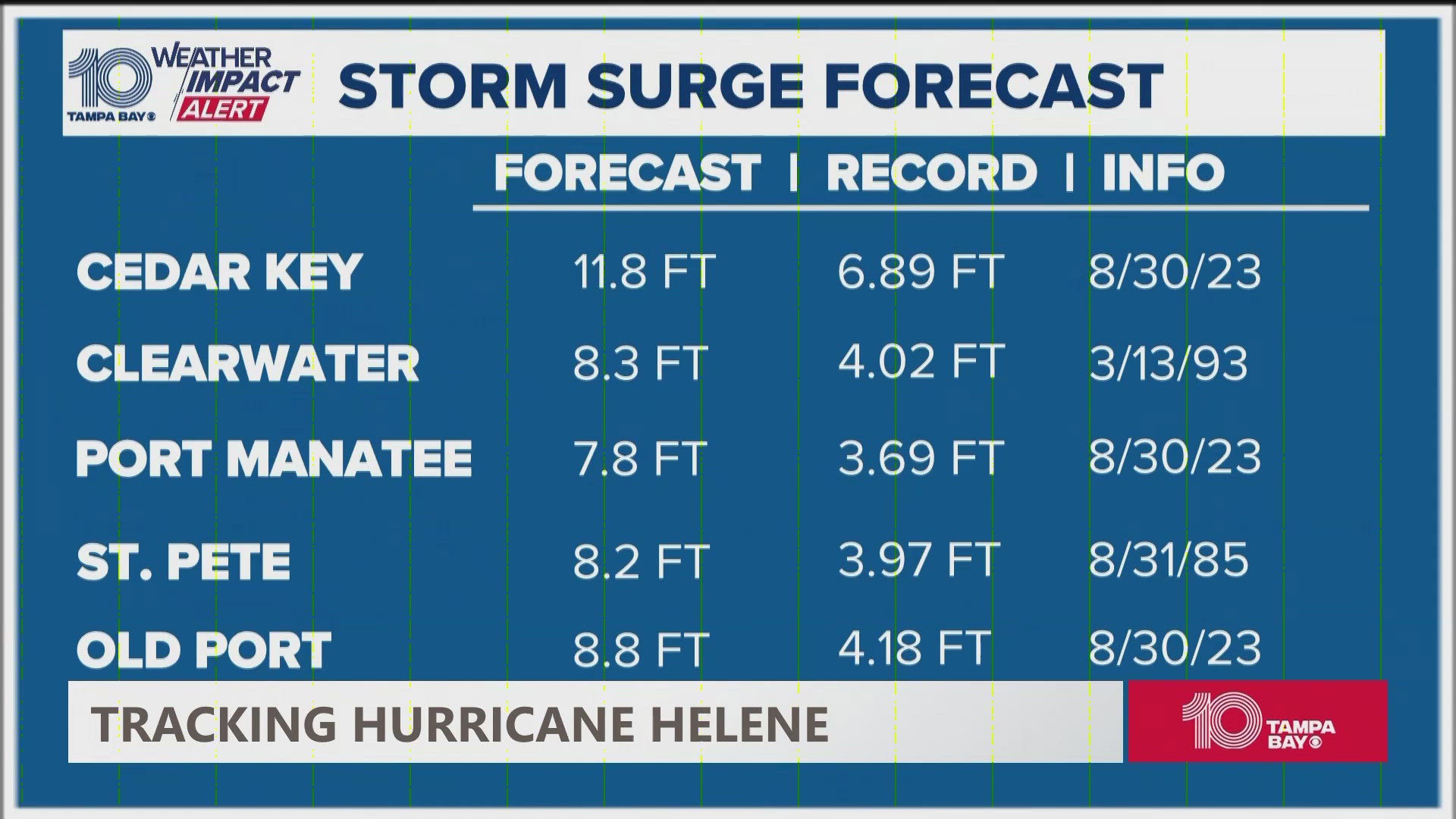
Storm surge from Helene is expected to be significant, forecasted at over 10 feet high for areas throughout Tampa Bay. The overall impact, however, may be lessened due to Helene's timing.
The hurricane is expected to make landfall late Thursday evening, just after when Tampa has historically experienced low tide, according to the National Oceanic and Atmospheric Administration's Tides & Currents webpage. High tide in Tampa usually peaks daily at around 9:40 a.m.
NOAA said the worst flooding happens when high tide and landfall coincide.
"Rise in water level can cause extreme flooding in coastal areas, particularly when storm surge coincides with normal high tide, resulting in storm tides reaching up to 20 feet or more in some cases," according to NOAA.
Numerous other factors affect surge height, including:
- wind speed
- forward speed
- radius of maximum winds
- angle of approach
- width and slope of the ocean bottom
- shape of the coastline
"Adding to the destructive power of surge, battering waves may increase damage to buildings directly along the coast," NOAA said.
"Water weighs approximately 1,700 pounds per cubic yard; extended pounding by frequent waves can demolish any structure not specifically designed to withstand such forces. The two elements work together to increase the impact on land because the surge allows waves to extend inland."