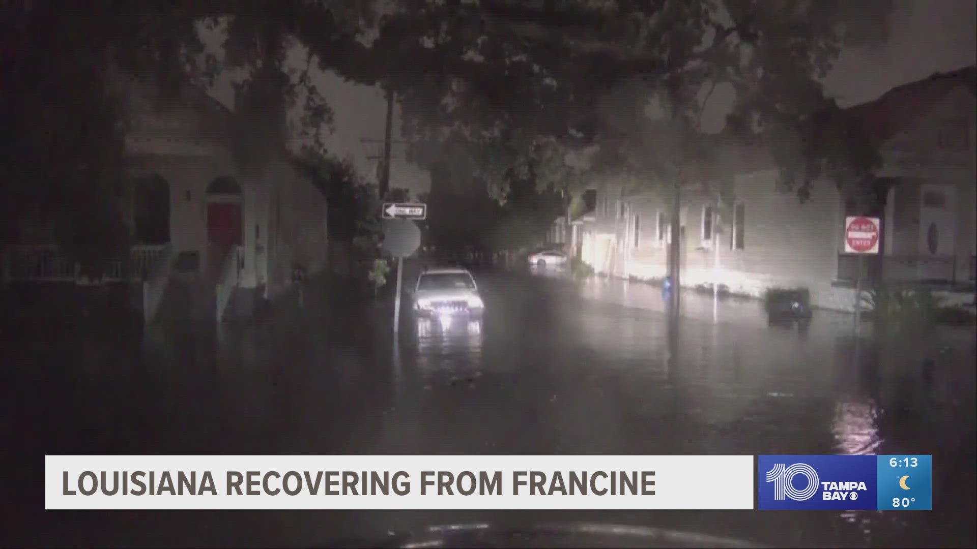
ST. PETERSBURG, Fla. — Hurricane Idalia is in the Gulf of Mexico and is expected to become a major hurricane — Category 3 or higher — before making landfall along Florida's Gulf Coast.
The immediate Tampa Bay area is just out of the cone of uncertainty, but life-threatening storm surge and strong winds are possible.
Computer models have shifted the storm a tad farther away from the Tampa Bay coast, but it's important to stress small shifts will continue before the storm makes landfall — and parts of the region will still experience the "dirty" side of the system.
A hurricane warning is in effect from the middle of Longboat Key northward to Indian Pass, including Tampa Bay. A storm surge warning is in effect for Englewood northward to Indian Pass, including Tampa Bay.
Of course, depending on where you are in the Tampa Bay area, you can expect different conditions. Let's break down what each county can expect ahead of Idalia.
10 Tampa Bay is keeping you ahead of the storm: Download our free mobile app for real-time storm information and breaking alerts, and download 10 Tampa Bay+ for your favorite streaming device for live updates.
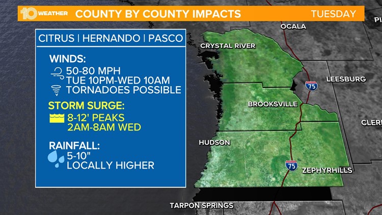
Citrus | Hernando | Pasco counties


Citrus, Hernando and Pasco counties can expect winds starting Tuesday night between 50-80 mph. Tornadoes are possible. Peak storm surge could reach 8-12 feet early Wednesday morning. Between 5-10 inches of rainfall is expected across the area, with some local spots receiving more.
Pinellas | Hillsborough counties

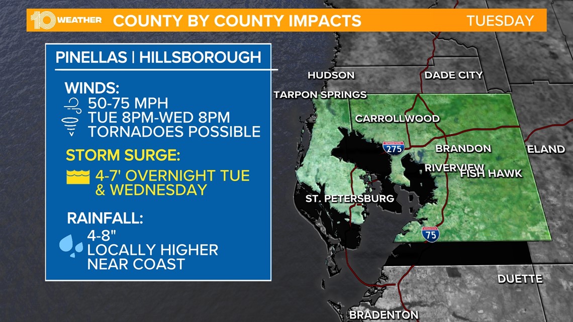
Pinellas and Hillsborough counties can expect winds starting Tuesday night between 50-75 mph. Tornadoes are possible. Peak storm surge could reach 4-7 feet overnight Tuesday into early Wednesday morning. Between 4-8 inches of rainfall is expected across the area, with some local spots receiving more.
Manatee | Sarasota counties

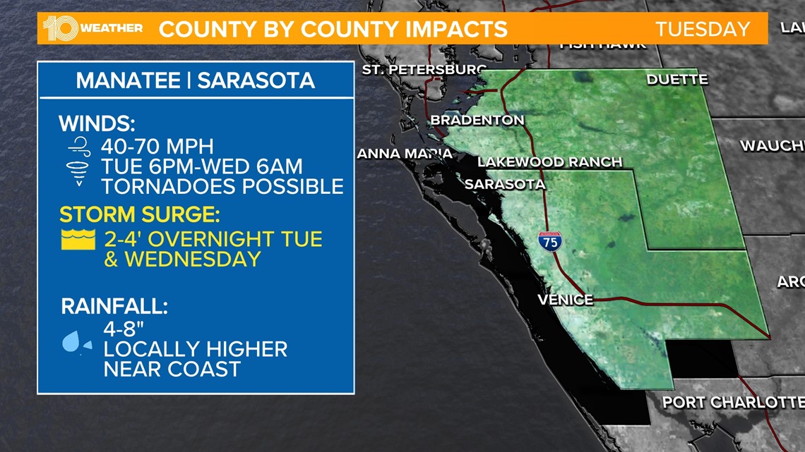
Manatee and Sarasota counties can expect winds starting Tuesday night between 40-70 mph. Peak storm surge could reach 2-4 feet overnight Tuesday into early Wednesday morning. Between 4-8 inches of rainfall is expected across the area, with some local spots receiving more.