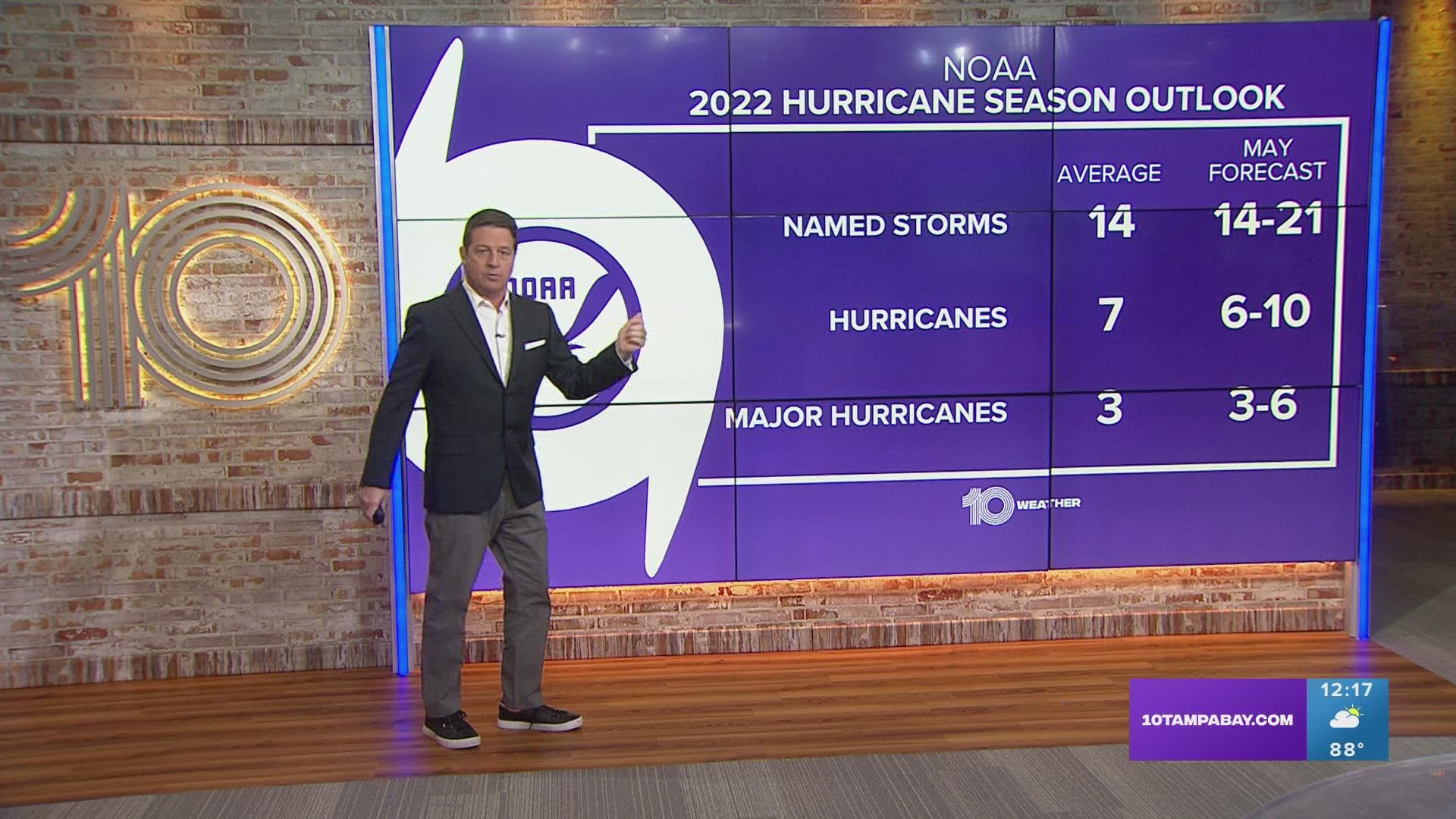
TAMPA, Fla — The National Oceanic and Atmospheric Administration, along with other organizations, are predicting yet another above-average hurricane season. This would be the seventh consecutive year of above-normal activity in the Atlantic.
As we near the official start of hurricane season, which begins June 1, it is important to break down the reasons why forecasters are calling for another active storm season in the Atlantic basin.
An ongoing La Niña
The possible continuation of La Niña is one contributing factor to the above-normal season forecast this year.
La Niña — a naturally occurring counterpart to the more known "El Niño" pattern — begins when tropical waters in the eastern Pacific cool to below-average temperatures.

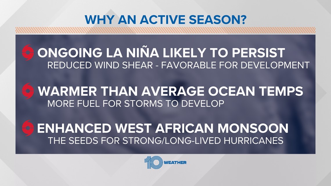
While in a La Niña, weather patterns across the country shift a bit. But in the tropical Atlantic, this pattern tends to reduce wind shear. Vertical wind shear inhibits hurricane development by preventing thunderstorms in tropical systems from organizing and gaining strength.
Wind shear essentially rips the tops of these thunderstorms apart and disrupts the structure of tropical storms and hurricanes.

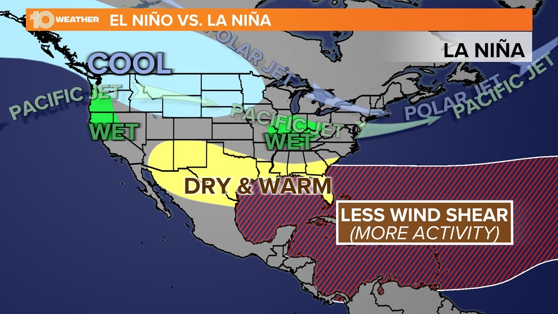
In a La Niña, westerly upper-level winds tend to stay farther to the north and away from the tropical Atlantic basin. That increases the likelihood of hurricane development as hurricanes thrive in environments of low wind shear.
Experts at the Climate Prediction Center state that while La Niña looks to continue into the summer months, "the odds for La Niña decrease into the late Northern Hemisphere summer (58% chance in August-October 2022) before slightly increasing through the Northern Hemisphere fall and early winter 2022 (61% chance)."
Above-average sea surface temperatures
Tropical storms and hurricanes are fueled by warm ocean waters — a main ingredient required for tropical storms to thrive and even rapidly intensify.

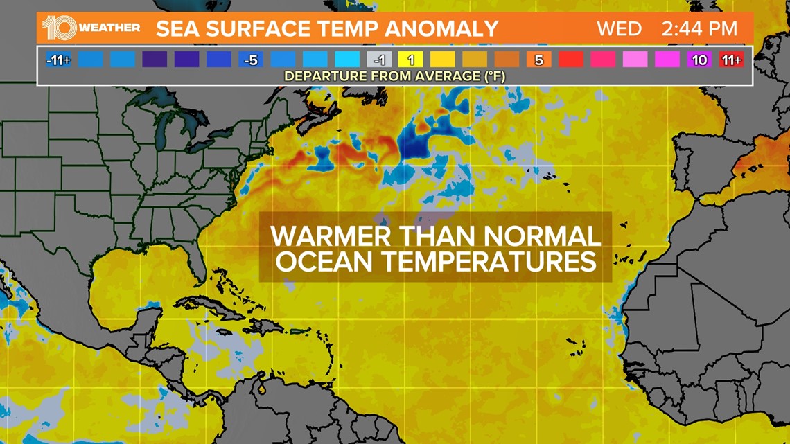
Current sea-surface temperatures have been running above average. In the image above, all the areas in yellow/orange are experiencing warmer than average water temperatures. If these sea surface temperatures continue to run a fever, storms will benefit from that energy through the season.
Strong West African monsoon
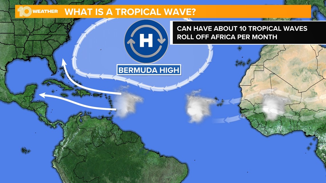
An enhanced West African monsoon allows wind patterns coming off of the African coast to produce a number of tropical waves, which are areas of low pressure that move westward off of the coast of Africa. These waves seed many of the strongest and longest-lived hurricanes, especially during the peak months of August and September.

While these factors favor a more active season, it only takes one storm to make an impact. It is important to get prepared now ahead of rapidly-changing conditions, so stay with 10 Tampa Bay for the latest as we approach another busy hurricane season.

