

ST. PETERSBURG, Fla. — People who live along the Texas/Louisiana coastline and didn't get out of harm's way need to hunker down from here on out: Hurricane Laura is hours away from landfall.
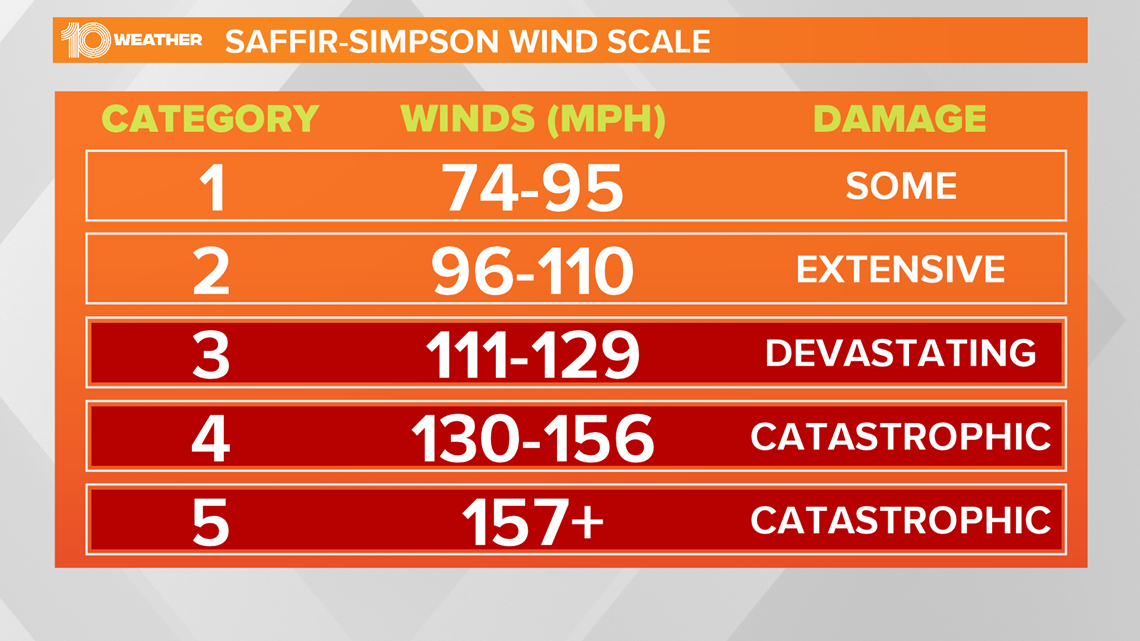
It is an "extremely dangerous," 150-mph Category 4 storm, according to the National Hurricane Center's Wednesday evening advisory. Aside from the destructive winds, the NHC says a "catastrophic" storm surge of up to 20 feet is possible along the coastline.
"Unsurvivable storm surge with large and destructive waves will cause catastrophic damage from Sea Rim State Park, Texas, to Intracoastal City, Louisiana, including Calcasieu and Sabine Lakes," forecasters warned.
Hurricane Laura is about 75 miles south of Lake Charles, Louisiana, moving north-northwest at 15 mph.
As the storm continues nears the coastline over the Gulf of Mexico, the ingredients --- including warm sea surface temperatures and low wind shear -- remain for the storm to intensify, forecasters said.
A NOAA Hurricane Hunter recon flight showed Laura strengthened into a major, Category 3 storm around 8 a.m. Wednesday, with maximum sustained winds of 115 mph.
By 2 p.m., the NHC said Laura had 140-mph winds.
A storm is considered "major" at Category 3 or higher, with maximum sustained winds of 111 mph or greater.
Laura is the first major hurricane of the 2020 Atlantic season.

A storm surge warning is in effect for:
- Freeport, Texas, to the Mouth of the Mississippi River
A hurricane warning is in effect for
- San Luis Pass, Texas, to Intracoastal City, Louisiana
A tropical storm warning is in effect for:
- Sargent, Texas, to San Luis Pass
- East of Intracoastal City, Louisiana, to the Mouth of the Mississippi River
A storm surge watch is in effect for:
- Mouth of the Mississippi River to Ocean Springs, Mississippi
- Lake Pontchartrain, Lake Maurepas, and Lake Borgne
A hurricane watch is in effect for:
- East of Intracoastal City to west of Morgan City, Louisiana
The deepest storm surge is forecast to be along the immediate coast near and to the right of the landfall location, accompanied by large and destructive waves. Surge-related flooding depends on the relative timing of the surge and the tidal cycle and can vary greatly over short distances, according to the NHC.
This year, the tropics have been especially active. There already have been 13 total named storms in 2020.
Hurricane Laura is the earliest "L" name on record, beating Hurricane Luis, which formed on Aug. 29, 1995.
►Breaking news and weather alerts: Get the free 10 Tampa Bay app
►Stay In the Know! Sign up now for the Brightside Blend Newsletter