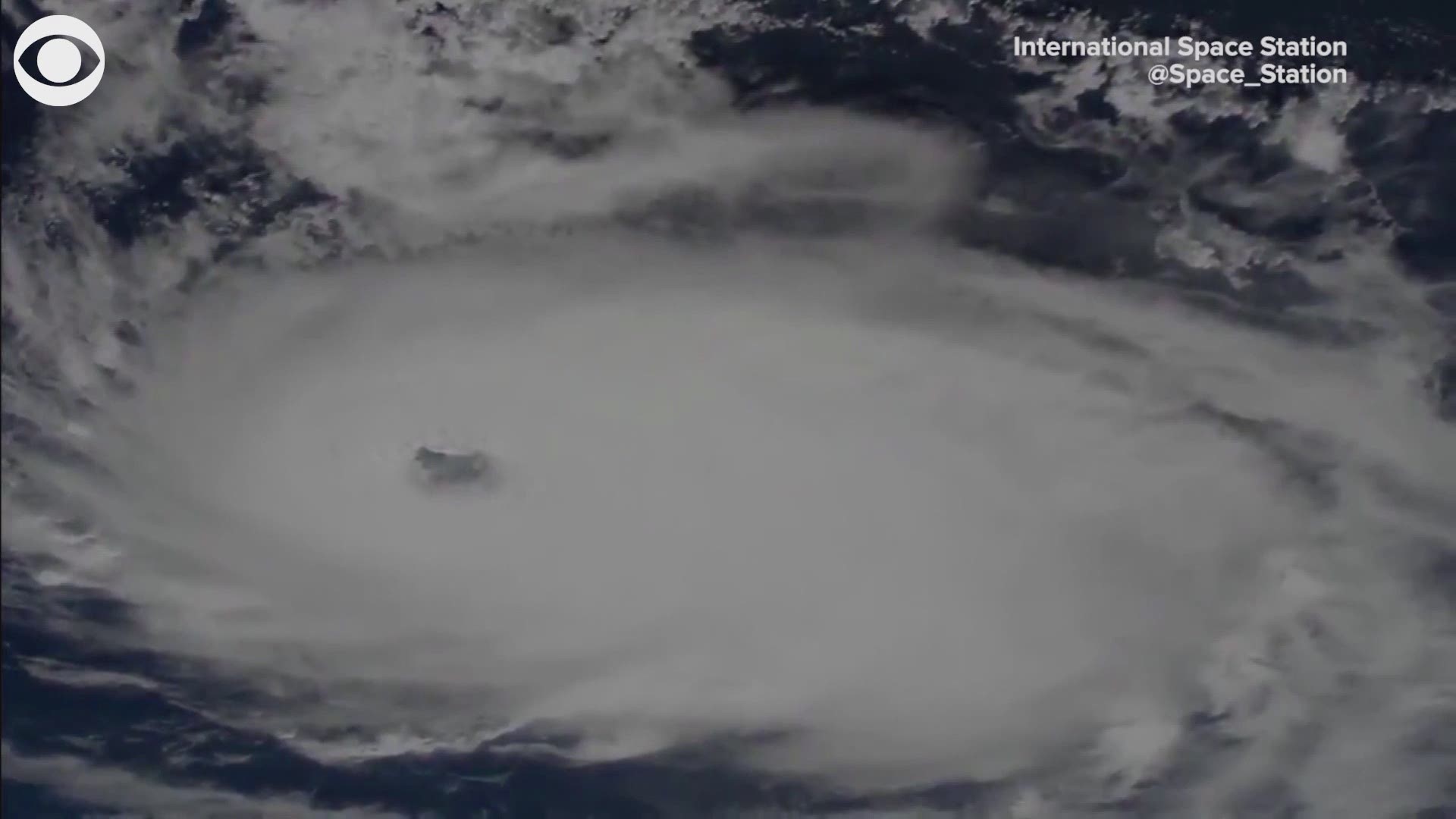
ST. PETERSBURG, Fla. — Hurricane Dorian as seen from space: Incredible, maybe. Menacing, yes.
Cameras positioned outside the International Space Station captured awe-inspiring views of the powerful storm as it moved overhead Saturday. As a Category 4 hurricane at the time the video was taken, the eye of Dorian appeared obvious.
It's not a satellite image but an actual, bird's-eye view of the storm. NASA said the images were taken at 11:28 a.m. Saturday.
Earlier on Friday, NOAA Satellites tweeted an image of the lightning associated with the strengthening storm. Lightning typically isn't associated with tropical cyclones but those that show an uptick in strikes usually are on the course of strengthening.
Prolonged life-threatening storm surge and devastating hurricane-force winds are expected Sunday through early Monday for the northwest Bahamas.
Hurricane Dorian is moving westward, but a shift to the north is expected during the next several days. Although the official forecast track by the National Hurricane Center has shifted more so to the east, there remains some uncertainty in exactly when and just where that turn to the north will occur.
10Weather and National Hurricane Center meteorologists expect the core of Dorian to continue a churn toward the northwestern Bahamas on Sunday and approach Florida's east coast on Monday.
What other people are reading right now:
- Hurricane Dorian an 'extremely dangerous' Category 4 hurricane
- Live blog: The latest, need-to-know information on Hurricane Dorian
- 5 dead, 21 injured in second mass shooting in weeks in West Texas
- There've already been 1,000 reports of suspected price gouging in Florida as Dorian approaches
- Orlando International Airport will now stay open through Dorian
►Make it easy to keep up-to-date with more stories like this. Download the 10News app now.
Have a news tip? Email desk@wtsp.com, or visit our Facebook page or Twitter feed.

