TAMPA, Fla. — Hurricane Helene is forecasted to reach Category 3 strength before making landfall in Florida's Big Bend region, the National Hurricane Center reported Wednesday evening.
Hurricane and storm surge warnings are in effect for parts of Florida's Gulf Coast, including the Tampa Bay area.
Ahead of potential impacts from the storm, many are wondering how far the storm's reach is.
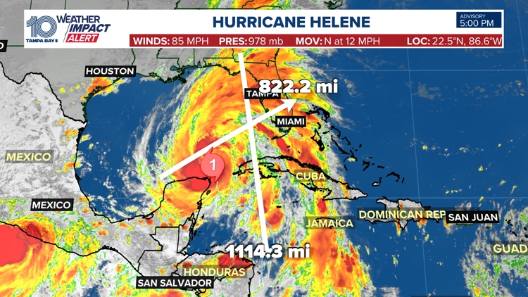
10 Tampa Bay's Weather Impact team forecast based off of satellite imagery estimates that Helene stretches 822.2 miles in width and 1114.3 miles in length.
With those distances, the storm's outer bands reach from the coast of Honduras northward into the state line of Georgia. Talking width, the storm measures from the coast of the Yucatan to the eastern side of the Florida peninsula.
Helene is so large in size, that hurricane warnings stretch roughly 90 miles north of the Georgia-Florida line.
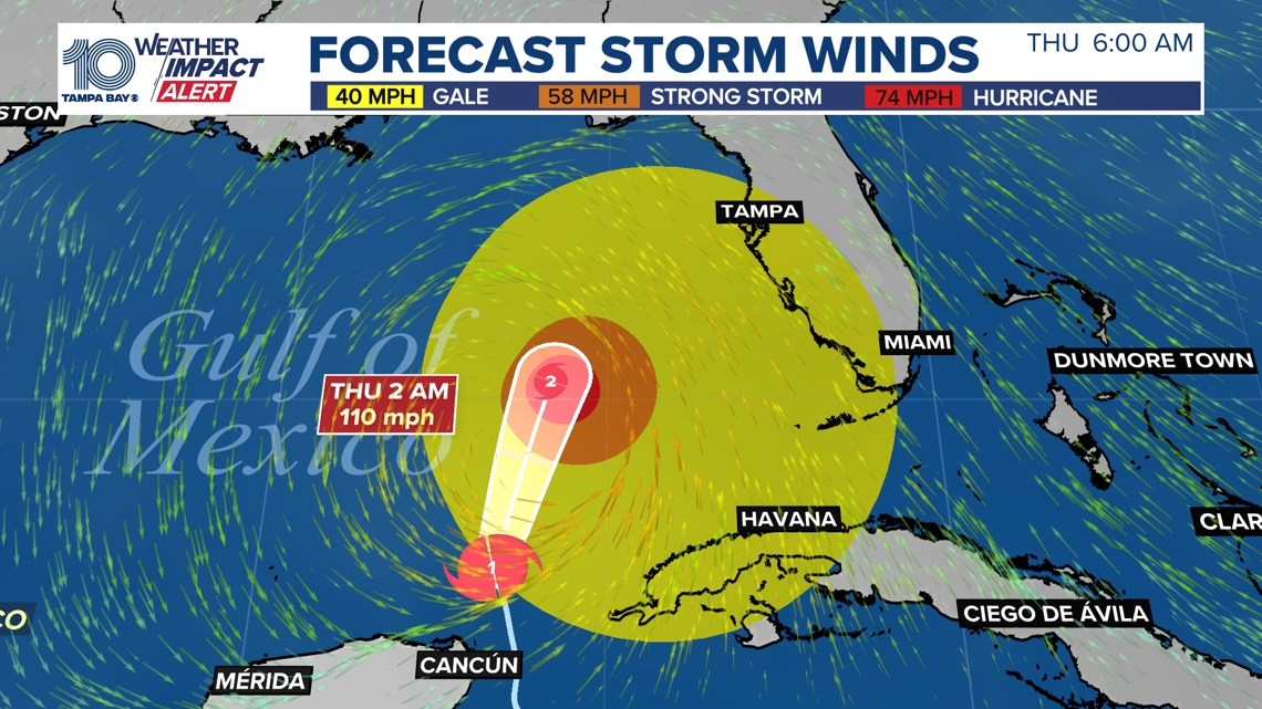
When talking impacts, Helene's tropical storm force wind field before landfall is anticipated to be approximately 370 miles wide. With a wind field that large, Tampa Bay can expect to start experience Tropical Storm Force winds as early as Thursday morning.


Impacts:
Surge: Citrus, Pasco and Hernando counties could see 6-15 feet. Meanwhile, Hillsborough County could see 5-8 feet while Manatee and Sarasota Counties could see 4-7 feet. Lastly, inland counties like Polk, Hardee, Desoto and Highlands could see 1-3 feet.
Rain: 4-8 inches possible
Wind: 45-55+ mph sustained winds
Severe Weather: Isolated tornadoes possible, a level 1 risk
A storm surge warning has been issued for:
- Mexico Beach eastward and southward to Flamingo
- East of Mexico Beach to Indian Pass
- Tampa Bay
- Charlotte Harbor
A storm surge watch is in effect for West of Indian Pass to Mexico Beach
A hurricane watch has been issued for the Cuban Province of Pinar del Rio and Englewood to the Anclote River, including Tampa Bay.


