ST. PETERSBURG, Fla. — New satellite images show before and after visuals along Florida's coast after Hurricane Helene.
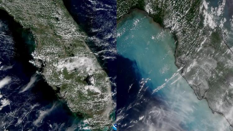
In a post from NOAA on X, images from the Joint Polar Satellite System show the upwelling of water and sediment in the eastern Gulf of Mexico. The before image was taken on Wednesday, Sept. 24, while the after image was taken on Saturday, Sept. 27.
The after image shows a much lighter blue color stretching from Florida's Big Bend region down to Southwest Florida due to sediment stirred up by the hurricane.
Hurricane Helene brought extreme winds and flooding to much of the sunshine state, including record-breaking storm surge to the Tampa Bay area as it made landfall as a powerful Category 4 in the Big Bend region.
Fallen trees damaged homes and cars, and hundreds of calls for service came to different law enforcement and fire rescue agencies across our local counties.
From Hernando to Sarasota counties, Hurricane Helene's historic storm surge battered the Gulf coast. Homes were destroyed and businesses were lost.
If you were affected by Helene in the Tampa Bay area, 10 Tampa Bay has a list of county-by-county resources.