
ST. PETERSBURG, Fla. — The National Weather Service has issued a flash flood watch for parts of the Tampa Bay area through Friday afternoon.
The watch is in effect through 1 p.m. Friday for the following areas:
- Coastal and inland Charlotte
- Coastal and inland Lee
- Coastal and inland Citrus
- Coastal and inland Hernando
- Coastal and inland Hillsborough
- Coastal and inland Levy
- Coastal and inland Manatee
- Coastal and inland Pasco
- Coastal and inland Sarasota
- Desoto
- Hardee
- Highlands
- Pinellas
- Polk
- Sumter
RELATED: Tracking Eta: NOAA finds storm a little stronger, tropical storm warning issued for Tampa Bay area
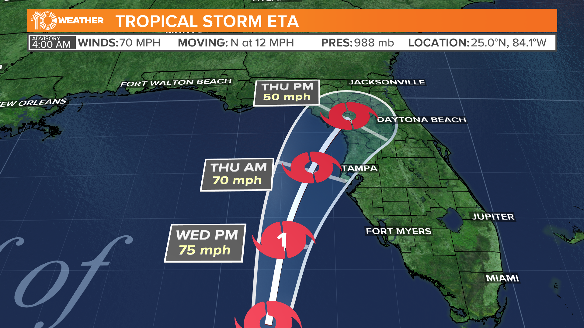
The NWS in Ruskin said Hurricane Eta is expected to move closer to west-central Florida over the next 48 hours and could likely make landfall somewhere in the Big Bend area.
"Areas on the east side of Eta's circulation will experience heavy rainfall with outer rain bands that will train over the same area," the NWS said.
The NWS said periods of excessive rain can produce flash flooding, especially in urban areas and along small creeks and streams.
As of Wednesday morning, Hurricane Eta was about 145 miles south-southwest of Tampa, Florida. It has maximum sustained winds of 75 mph and is moving north-northeast at 10 mph.
A tropical storm warning and a storm surge warning were issued for parts of Florida's west coast, including the Tampa Bay area.
►Breaking news and weather alerts: Get the free 10 Tampa Bay app
►Stay In the Know! Sign up now for the Brightside Blend Newsletter