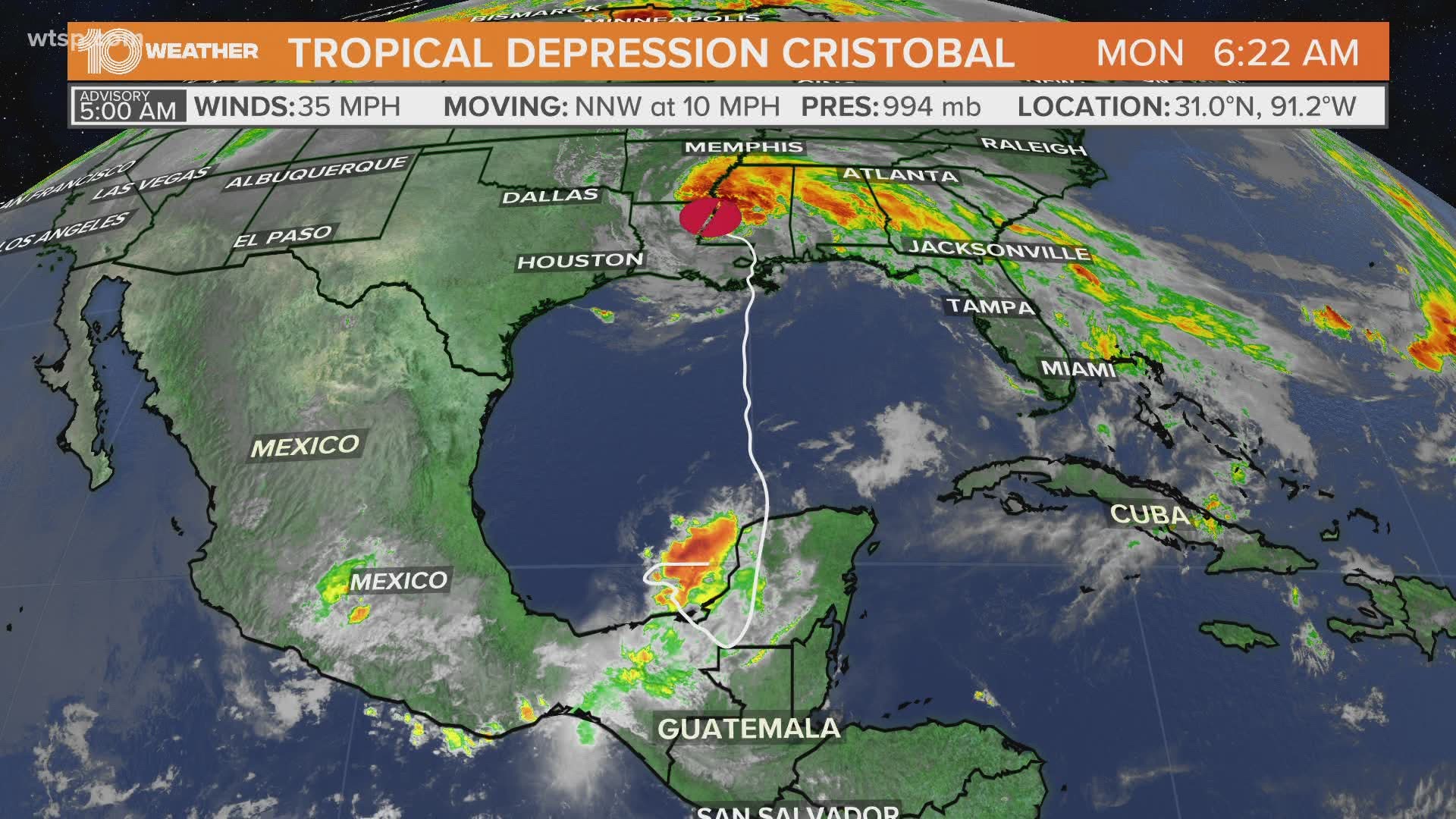
ST. PETERSBURG, Fla. — Tropical Storm Cristobal made landfall on the coast of Louisiana Sunday evening and as that system continues to gradually weaken and track north, there is another system to keep an eye on in the middle of the Atlantic.


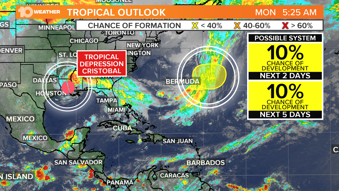
A non-tropical area of low pressure is expected to form along a frontal boundary a few hundred miles east of Bermuda over the next couple of days.
Environmental conditions are expected to be only marginally conducive for the low to acquire subtropical characteristics before the end of the week. At this time there is only a 10-percent chance of it developing into a subtropical depression.


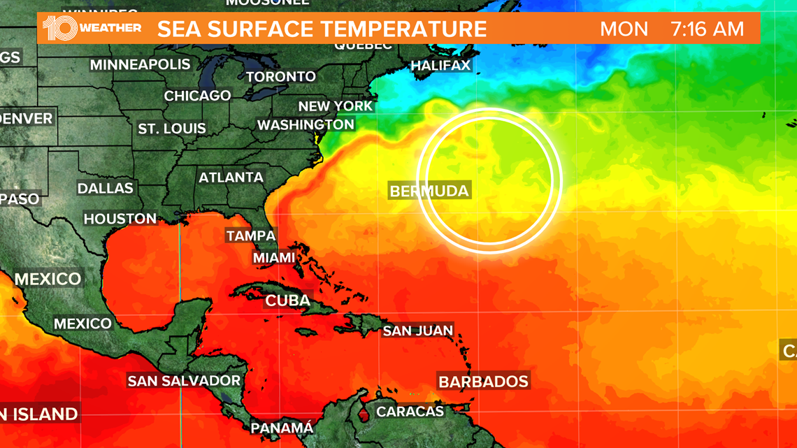
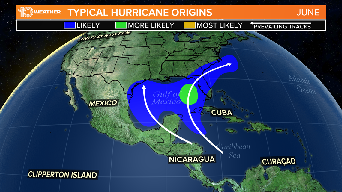
The water in the central Atlantic is still relatively cool and not quite capable of supporting tropical development at this point. The warmer waters in the Caribbean, Gulf of Mexico and waters off the U.S. Southeast coast are where tropical systems have historically shown most likely to develop early in the season.


Even though the 2020 Atlantic hurricane season has gotten off to a fast start with three named storms so far, typically a named storm only develops in the month of June once every other year.
What other people are reading right now:
- Weather service rates Orlando tornado as an EF-1
- Former Florida Gator, NFL wide receiver Rechell shot, killed in Tampa
- Amid national unrest, family still seeking justice after father dies in TPD custody
- Minneapolis City Council announces intent to disband police department
- Invasive, toxic toads reemerge in South Florida
- Tropical Storm Cristobal makes landfall in Southeast Louisiana
- Hillsborough County Sheriff's Office responds to "8 Can't Wait" campaign
FREE 10 TAMPA BAY APP:
►Stay In the Know! Sign up now for the Brightside Blend Newsletter


