ST. PETERSBURG, Fla. — It's never a good idea to let your guard down during hurricane season, and this one might be worth watching especially close.
Scientists at Penn State University's Earth System Science Center project the 2020 Atlantic hurricane season as the busiest in a decade. They say a combination of warm sea surface temperatures and other factors could result in the development of more named tropical cyclones than usual.
A tropical cyclone gets a name when it reaches tropical storm strength, with winds in excess of 39 mph.
The Penn State scientists said their best guess is 20 named storms this year. In a range, they're going with 15-24 storms total.
In 2016, they projected 19 named storms that season (15 was the actual count) and in 2010, their forecast was 23 (19 as the actual count). The past three years -- 2017, 2018 and 2019 -- were especially active, and scientists' guesses on the number of named storms were lower than what occurred.
But this season, "we predict one of the most active Atlantic hurricane seasons on record," tweeted scientist Dr. Michael E. Mann.
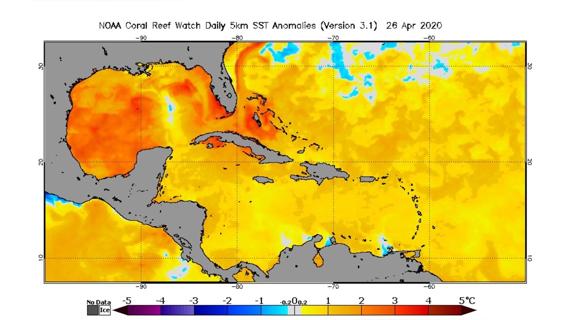
Sea surface temperatures are one of the main drivers of the development of tropical cyclones, and that can be checked off the list already this year. Why? Surface waters in the Gulf of Mexico and the Atlantic Ocean were above normal for the month of March and continue to tick a degree or two above average this April.
The Gulf of Mexico is especially warm right now. Despite its smaller size, compared to the wide-open Atlantic, storms that can make their way into a favorable area for development in the gulf can strengthen in a hurry. Floridians in the Panhandle know this when, in 2018, Hurricane Michael rapidly intensified into a Category 5 storm in just a couple of days as it tapped into warmer-than-average water.


Researchers are also watching whether El Niño or La Niña will develop. Government scientists at NOAA say the period right now remains neutral (neutral ENSO) and neutral conditions remain most likely, with La Niña as second-most likely and El Niño least likely.
A La Niña season has the tendency to harbor conditions that are more favorable for tropical cyclones in the Atlantic basin.
"Warmer than normal water, La Niña (and neutral ENSO) and more storms coming off of Africa are all ingredients that suggest more storms are possible and all look to be present this year," 10Weather Chief Meteorologist Bobby Deskins said.
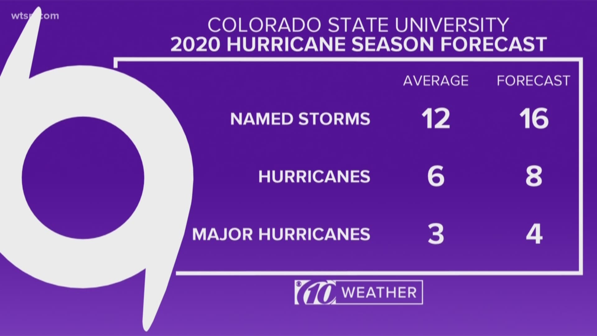
Deskins agrees with what the earlier forecasts are saying. Those from Colorado State University and North Carolina State University also predict a more active season.
But there's a caveat. This could be a busy season, but storms might not hit land. The 2010 Atlantic hurricane season was especially active, with 10 hurricanes, but not one of them hit the U.S.
It only takes one storm to have a season go into the history books, said Deskins, like the 1992 season: Hurricane Andrew developed later on into the season, and it's been remembered ever since.
"Whether the forecast is high or low, remember it only takes one. Hurricane Andrew hit in a year with only seven named storms, 12 is average," Deskins said. "It's key to note that these forecasts that predict a certain number or range of storm do not predict that any one spot will get hit with a hurricane.
"It just means we might be busier tracking storms this season."
And the best way to be ready for the season is to prepare now and to think about those hurricane preparedness plans.
Hurricane season runs from June 1 to Nov. 30.
- Sarasota County beaches reopen Monday with restrictions
- Key West reopens parks and beaches after 6-week shutdown
- What Florida beaches are open? A county-by-county list
- $10,000 worth of puppies and goods stolen from pet store
- Do your glasses fog up when you wear a mask? Here's how to fix that
- Tell them what you think: Re-Open Florida Task Force launches feedback portal
- Hotlines, websites offer the latest on COVID-19
FREE 10NEWS APP:
►Stay In the Know! Sign up now for the Brightside Blend Newsletter


