ST. PETERSBURG, Fla. — Have any plans for this upcoming weekend?
If they're outdoors, make sure to have your 10 Tampa Bay apps and enable notifications that will alert you to possible damaging storms ahead of time. All modes of severe weather are possible including isolated tornadoes, flash flooding and storm surges.
Wind gusts of 35-45 mph with isolated gusts to 70 mph are possible in the stronger thunderstorms.
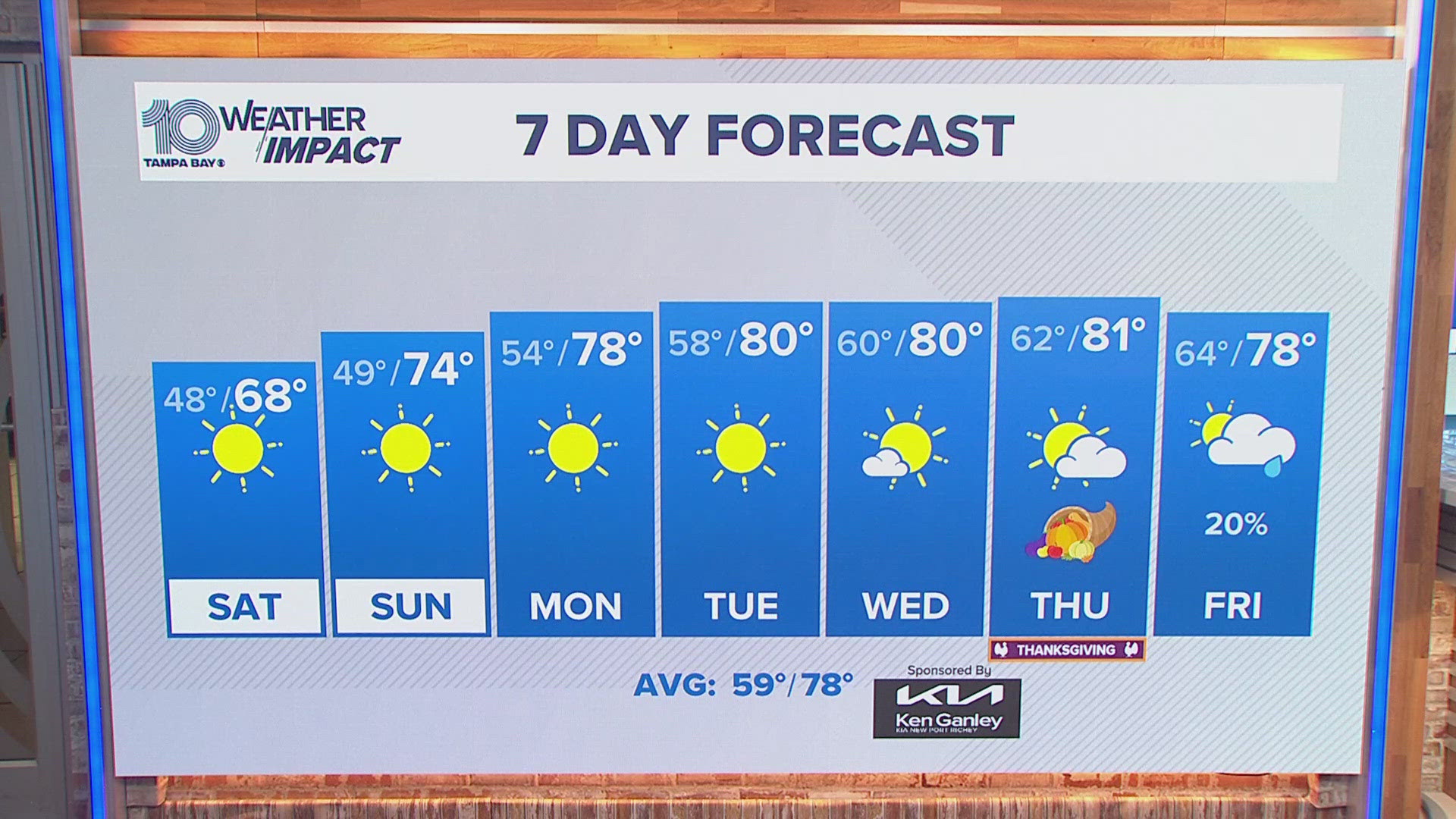
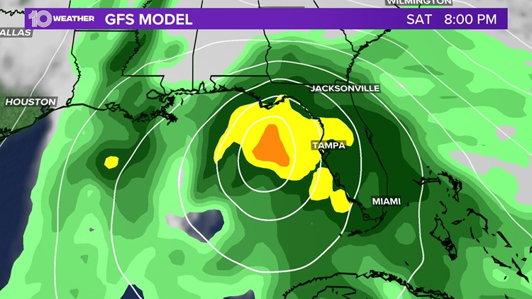
As a storm system is expected to develop in the Gulf on Friday, the latest long-range weather models continue to drift this system towards the west coast of Florida late Saturday, before crossing the state on Sunday. Expect conditions to deteriorate during the day on Saturday.


While the American, or GFS, model brings this low across the eastern Gulf into the Big Bend region, it also has this system moving slightly faster, with the bulk of the rain impacting central Florida on Saturday afternoon and Saturday night.

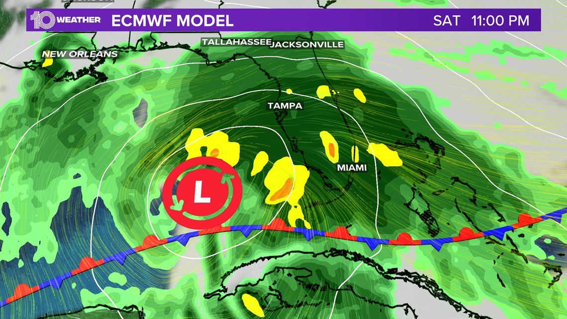
Meanwhile, the European model, or ECMWF, brings a slightly slower timing with this system as the heaviest rain and storms arrive late overnight Saturday through Sunday. Although the exact timing or location of these showers and storms remain unclear, it still appears to be a wet, windy and potentially stormy weekend for parts of our Saturday and Sunday.
Be sure to stay tuned for the latest updates as the forecast becomes clearer throughout the week.

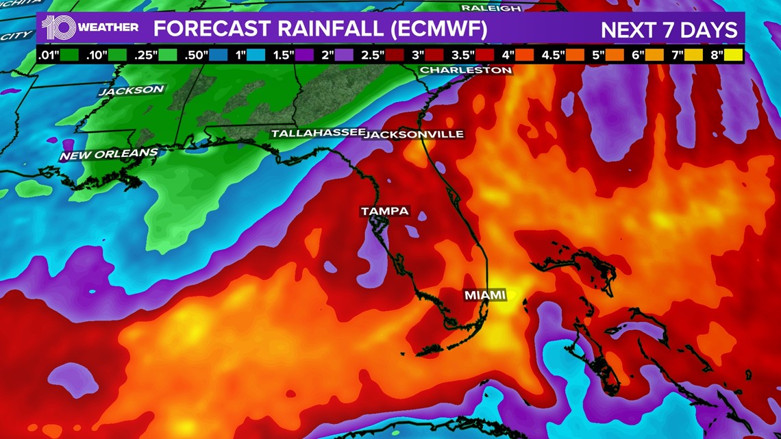
The good news is we should all get some much-needed rain with this system with most models averaging 1-3 inches of rain with locally higher amounts.