ST. PETERSBURG, Fla. — You can normally set your watch to late-day and evening thunderstorms this time of year, but nature seems to have lost track of time.
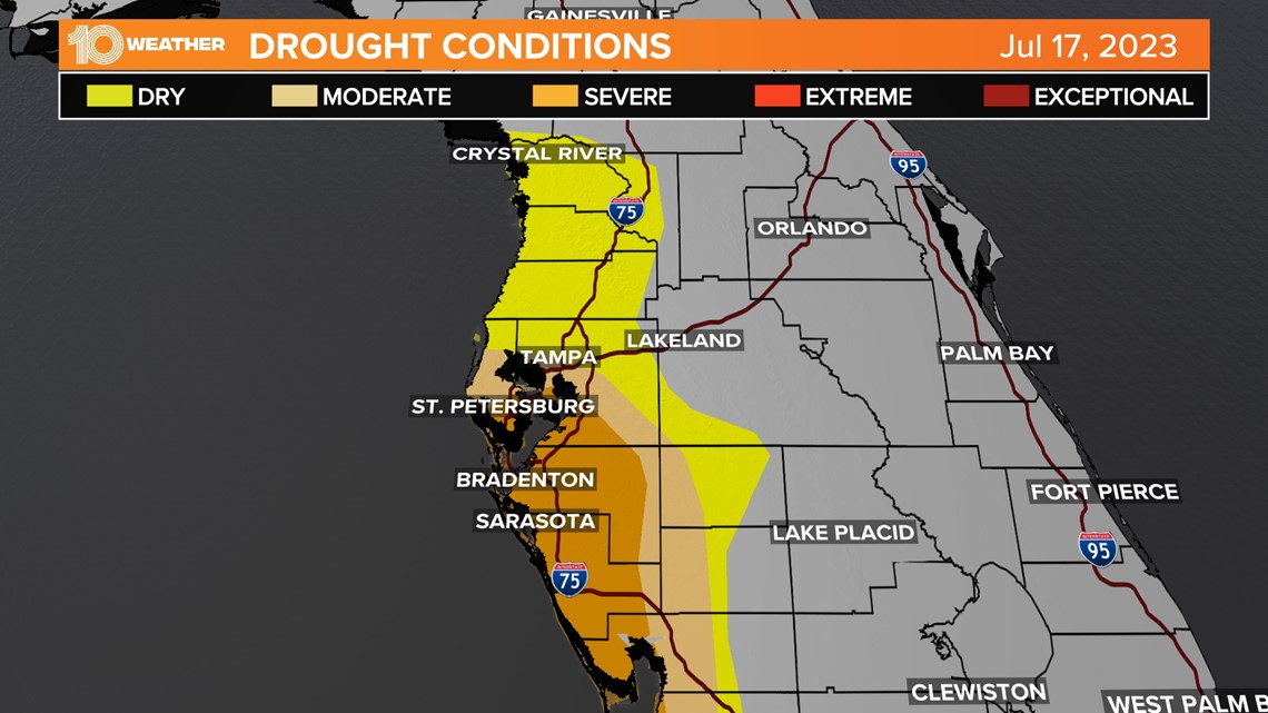
Here in Florida, most of our rainfall happens during our summer months — that hasn't been the case this year. It's been so dry that many of our coastal counties are in severe drought from Pinellas County down south. This includes southeast Hillsborough County. To put it in perspective, we have had only about half our normal precipitation.
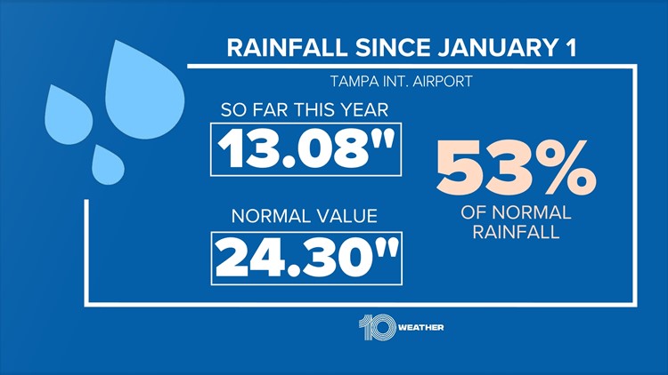
On average at Tampa International Airport, we should be at about 24 inches of rain for the year. So far this year, we have only had just over 13 inches of rain. Deficits are now running in double digits.
What this means is with no cooling storms, this summer has been all about protecting the "3 Ps" — people, pets and plants. The normal cooling thunderstorms we see in the afternoon have been replaced with an extra hot steambath that has included higher dewpoints or humidity.
Those factors, when combined with temperatures, make it feel like the triple digits for several hours every day by late morning lingering into the early evening.


The extra thick air bringing those suffocating heat index values is related to why it's been so dry. It's all about the west wind and it's not our friend when it comes to breaking out of this drought. The westerly flow or "steering flow" is coming in off the super-heated water making us feel like we live in a sauna.
It's very unusual for the west wind to be the area's dominant wind this long, but it's been that way since late May. This in turn has shifted the rainfall pattern across Florida.
Without an east-to-southeast wind colliding with the west coast sea breeze, the storm zone has shifted to the East Coast of Florida giving them all our needed rain.
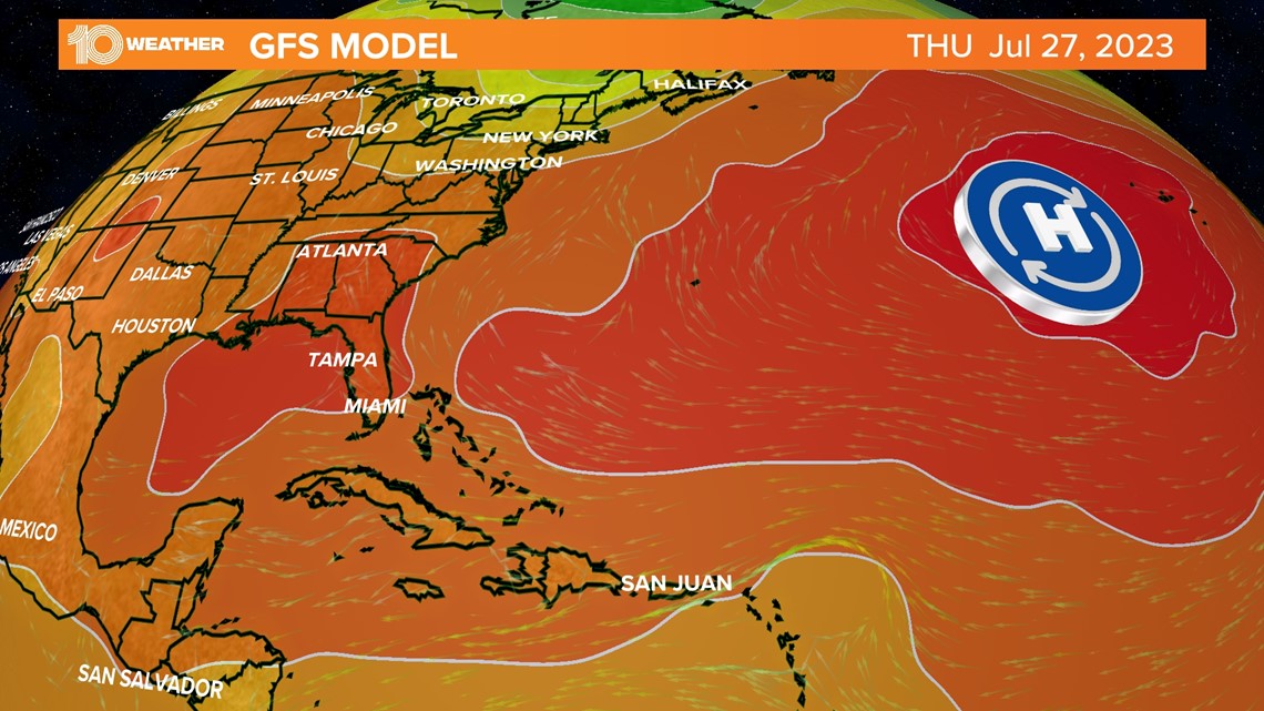
This pattern is being caused by unusually warm ocean temperatures in the Atlantic Ocean. This has shifted the Bermuda High-pressure system much farther east. This in turn has helped develop lower pressure in the Eastern United States creating plenty of stormy and severe weather for our friends in the Northeast and East Coast of Florida. But here on the West Coast of Florida, it's been the total opposite with the west wind pushing our storms east.


The good news is this pattern will likely break down in August and September as the tropical influence of cyclones and peak water temperatures help to change and break down the pattern.
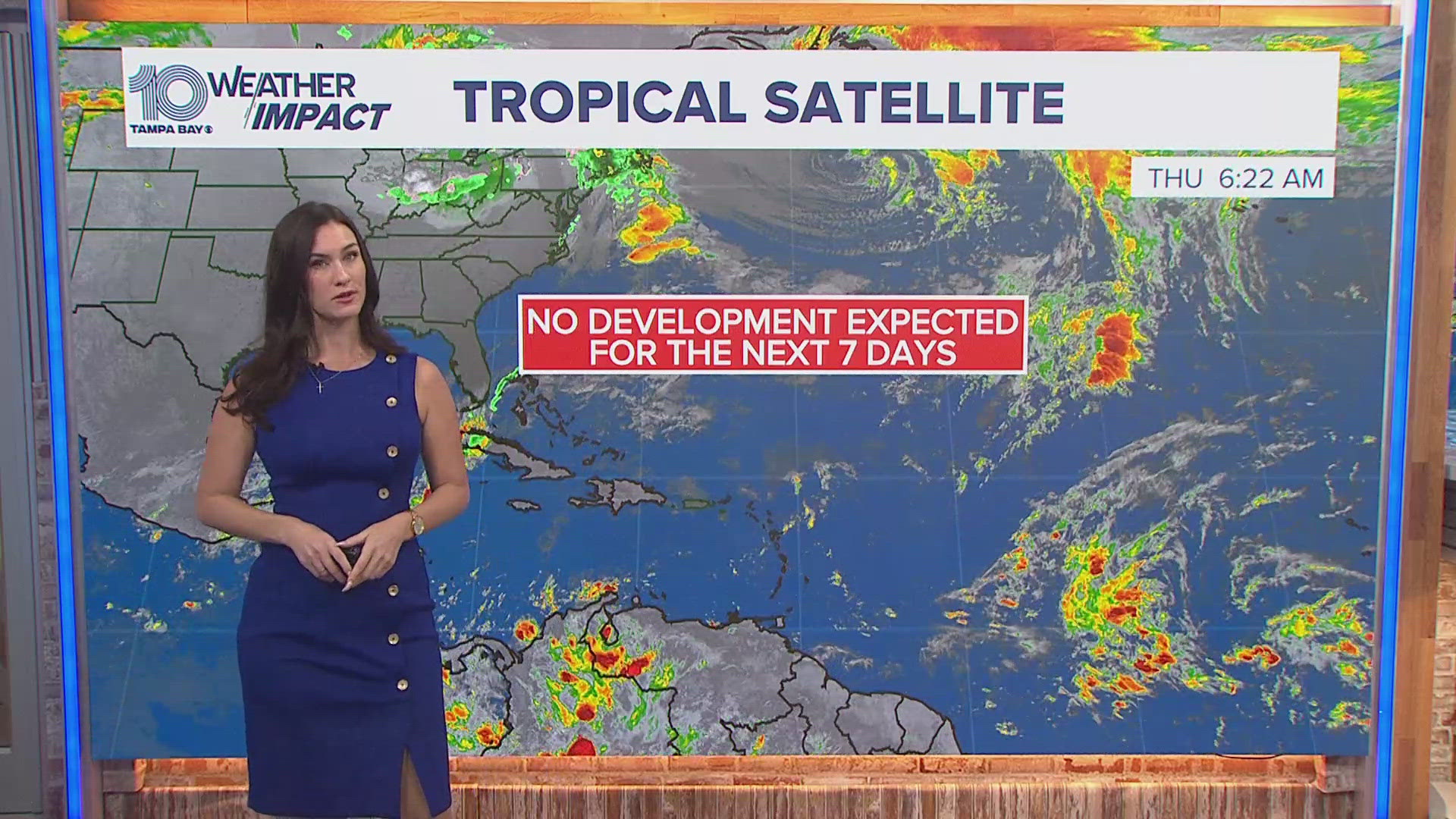
Keep in mind the peak season for hurricanes is not until late August and September. Now it's a good time to be prepared while the pattern is quiet. In the meantime, make sure to hydrate well. Check on the people, pets and plants.


