ST. PETERSBURG, Fla. — The well-advertised surge of tropical moisture into Florida is underway, with rainfall amounts expected to measure roughly 3-6 inches in the immediate Tampa Bay area.
This rain will improve the ongoing drought for most. The U.S. Drought Monitor reports abnormally dry to severe drought conditions existing primarily along and south of the Interstate 4 corridor, which will be the dividing line between areas that receive the heaviest rain.
We'll take a look at the two major weather computer models used to determine a rainfall forecast and show the differences. Although total rainfall amounts vary from place to place, the threat remains the same: Nearly everyone in the Tampa Bay area will receive rain, with higher amounts expected south.
Florida rainfall forecast
The European weather model below shows lesser rain amounts farther north into the Nature Coast and more rainfall in southwest Florida. It's possible that a heavier shower or storm could dump even more rain than what's shown.

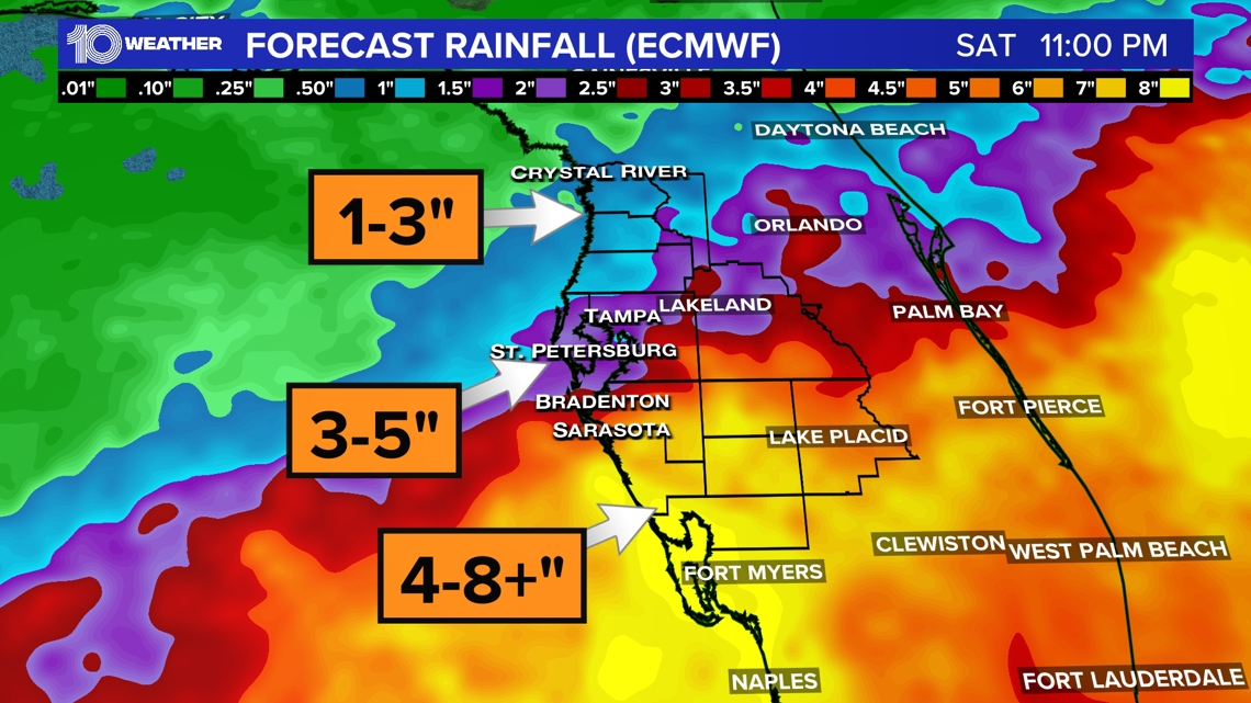
The best rain chances are likely now through Thursday. Remember, any slight shift in this surge of tropical moisture can impact rainfall totals. Thankfully, no severe weather is expected, but tropical heavy downpours are likely.
The dry ground should be able to absorb much of the excess water, however, areas that see intense rainfall could experience some isolated flooding.
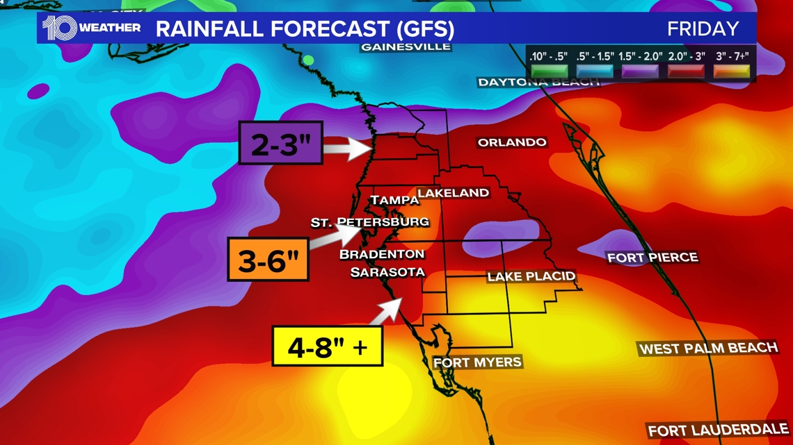
The GFS American weather model has been more aggressive with rainfall totals through the end of the week but has come more in line with the Euro model.

Tracking the tropics
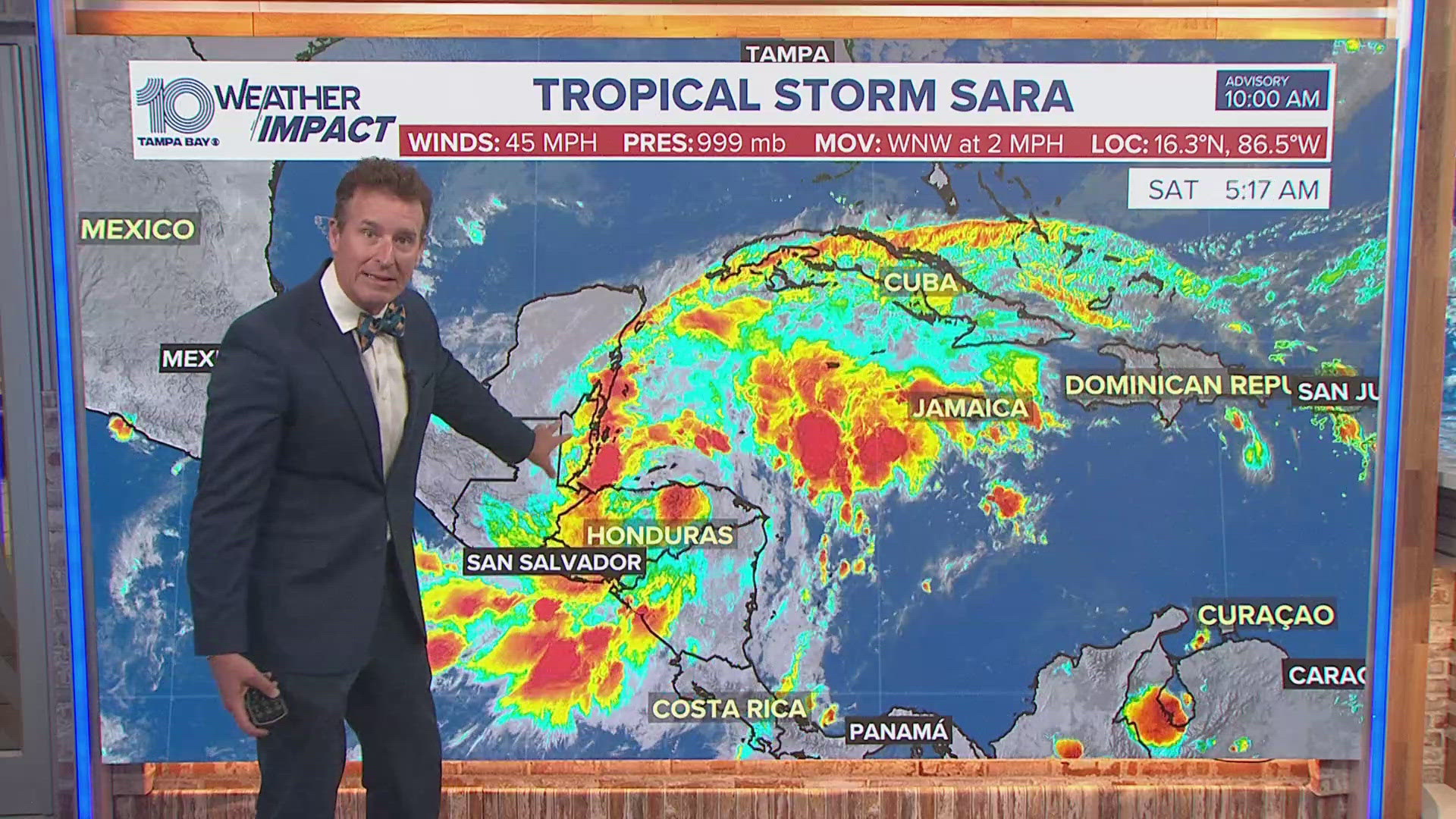
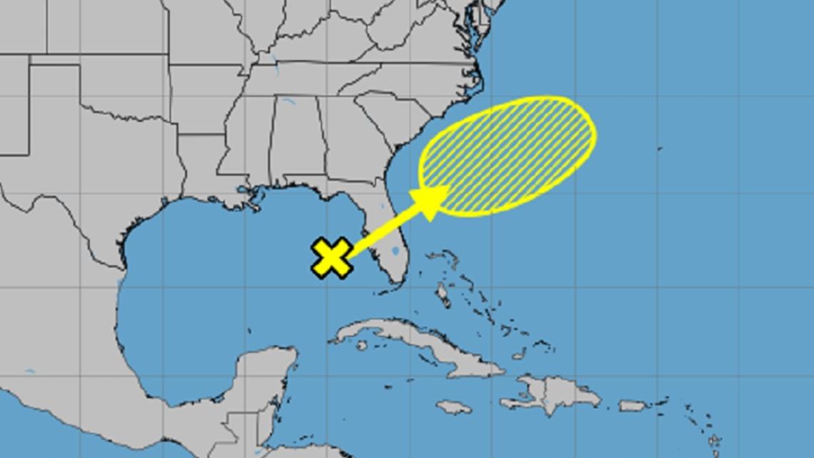
These increased rain chances are associated with a disturbance in the eastern Gulf of Mexico producing showers and thunderstorms. Tropical development is not anticipated, but National Hurricane Center forecasters say some slow organization is possible after it moves across Florida, dumping heavy rain in its wake, and then moves offshore along the southeastern U.S. coastline.
The hurricane center estimates this system has a 20% chance of development over the next week.

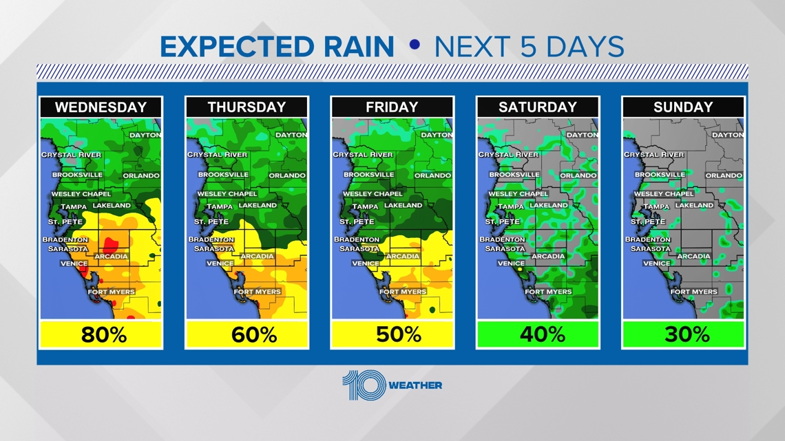
Higher rain chances are expected over the next five days, with the weekend not looking like a washout by any means. Still, hit-or-miss showers and storms could develop from time to time.

