ST. PETERSBURG, Fla. — Florida will soon go from drought to deluge, considering the amount of rain in this week's forecast.
A beneficial plume of tropical moisture will soon be steered from the Caribbean Sea into the Gulf of Mexico, bringing a significant pattern change that will increase our rain chances in Florida and help alleviate ongoing drought conditions.
The setup allowing this change to occur involves a broad area of low pressure near Mexico coinciding with a weak area of high pressure in the Atlantic. These will remain fairly stationary over the upcoming week, allowing a funnel of tropical moisture to travel into the Gulf of Mexico.

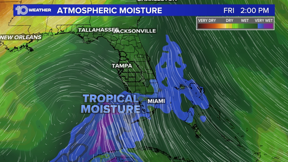
Although this won't be an all-day, everyday rain event, we expect a few healthy downpours throughout the week, with higher rain coverage kicking in around midweek.
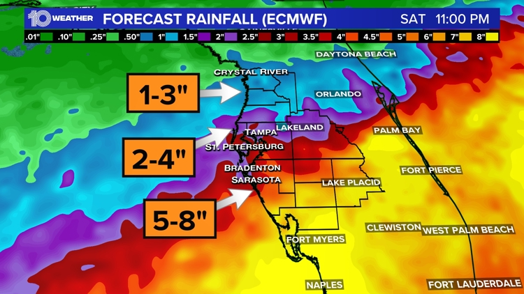
Florida rainfall forecast
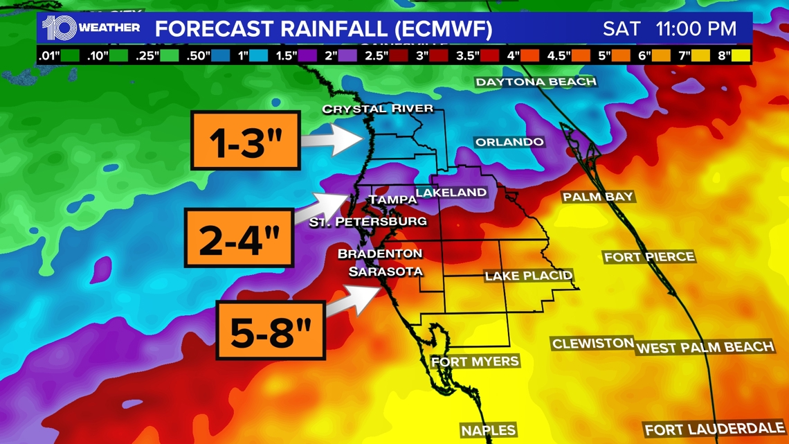
Widespread rain bringing 2-4inches to the immediate Tampa Bay area is expected, while our neighbors in southwest Florida could see more than a month's worth of rainfall in a matter of days, leading to flood concerns.
Farther north into the Nature Coast, rainfall amounts will be less. Higher amounts are anticipated south.

The silver lining to this anticipated rainfall event is that about half of the state is facing some level of drought. In our region, several counties have recently seen an uptick in brush fires due to severely dry vegetation and ample fuels.

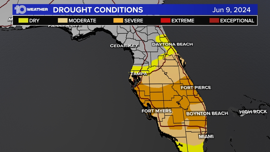
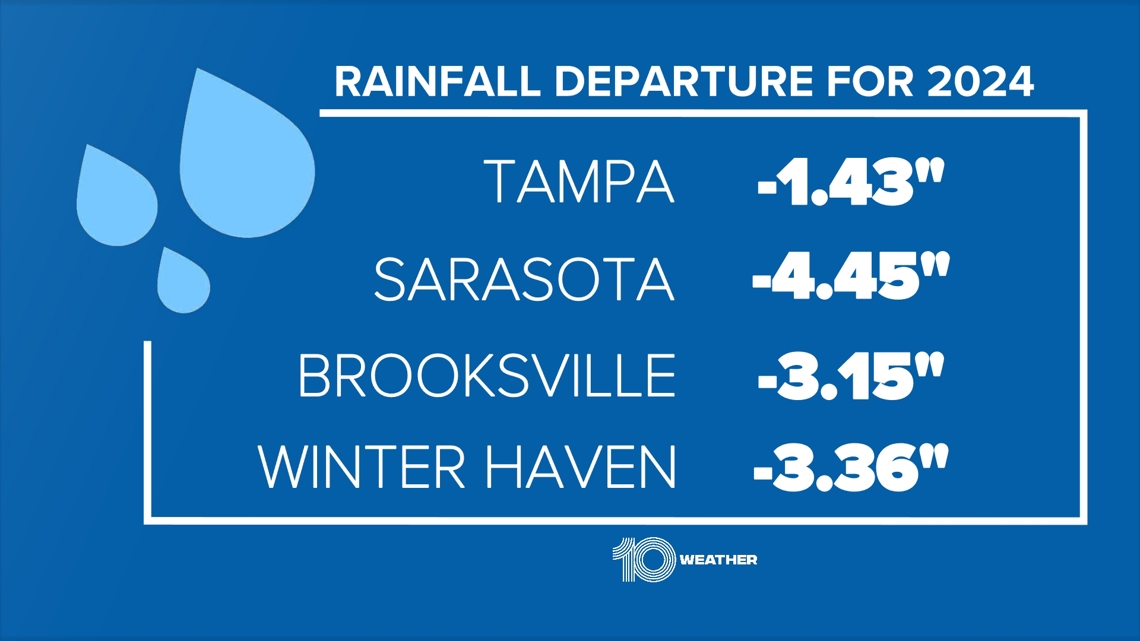
We're halfway through the year, and rainfall totals remain in a deficit across several cities. The rainy season normally kicks in from late May into early June, but so far, we have had a dry and uneventful start to the season.
This could be the push we need to get the ball rolling on our wet months, allowing us to catch up on rainfall totals that continue to lag behind.

