ST. PETERSBURG, Fla. — As Florida and the Tampa Bay area continue to recover from hurricanes Helene and Milton, many eyes are still on the tropics. There's already talk about the possibility of a new named system brewing, but we're getting ahead of ourselves.
Yes, the tropics remain relatively busy. And yes, there is a moderate chance for a system to develop. But here's the good news — there's no immediate threat to Florida.
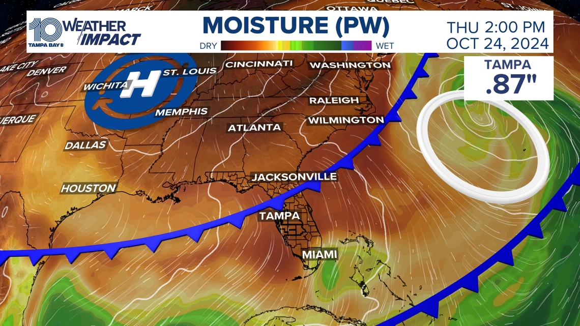
Big changes are happening in the Northern Hemisphere with more of a fall-like pattern in the middle and upper layers of the atmosphere. This pattern compliments a big ridge of high pressure developing in the central U.S.. This high will usher in cooler air and quieter weather.
This weather pattern typically helps suppress tropical activity much farther south because the drier, cooler air pushes the warmer air and moisture away. More good news — this pattern is set to stick around for at least the next couple of weeks.
It should help block tropical activity that develops from coming to Florida in the way we saw Debby, Helene and Milton impact the region.
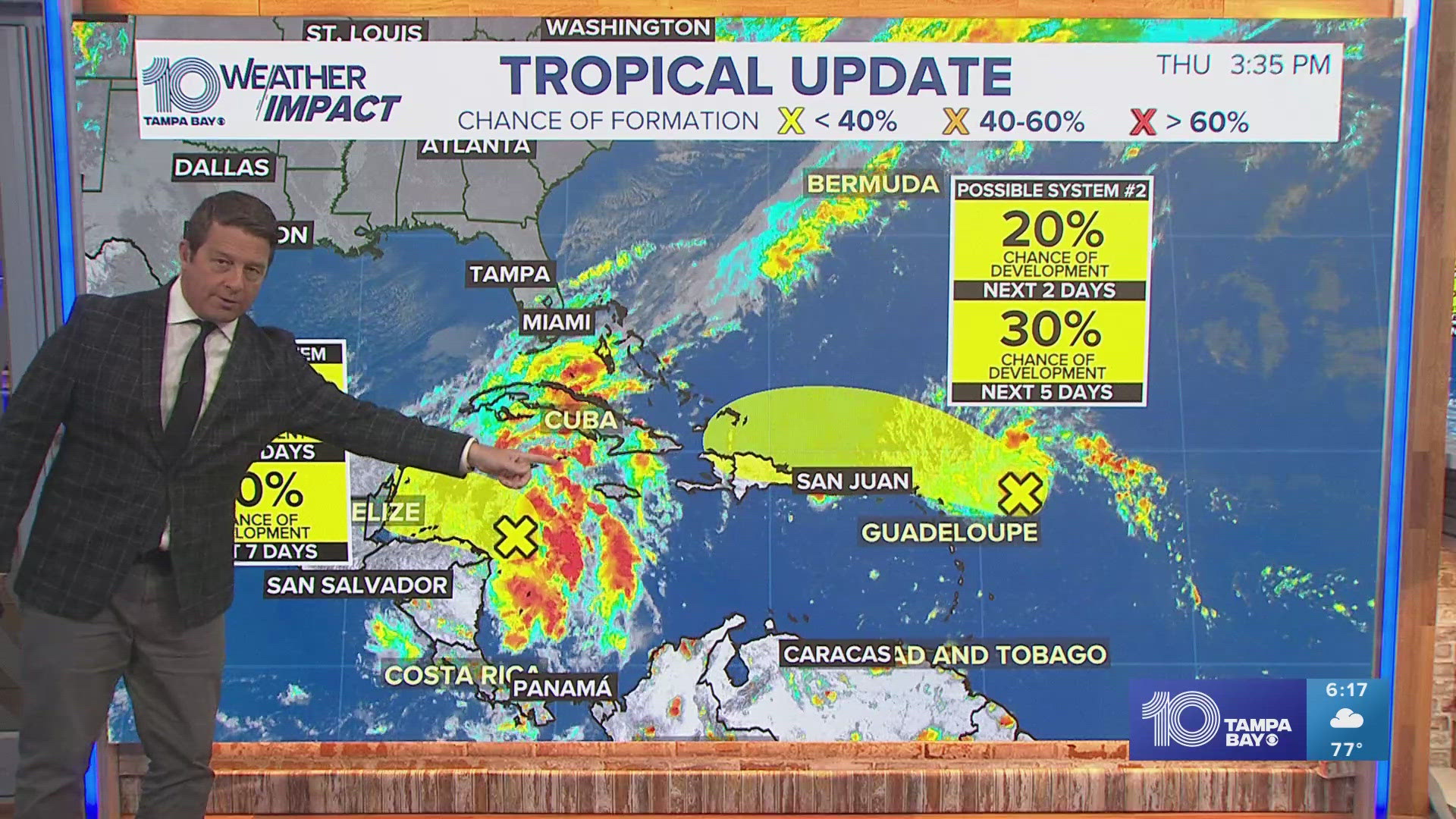
There is one disturbance in the central Atlantic that has a moderate chance of development in the next week. But thanks to high pressure and a couple of cold fronts, this system should stay south of the area. The overall shift in the upper-level winds helps keep us in a much lower risk area for any immediate concerns from tropical cyclones. Great news as the recovery effort continues.
A second disturbance in the southwestern Caribbean Sea has only a low chance of forming and is set to move toward Central America and away from the U.S. and Florida.


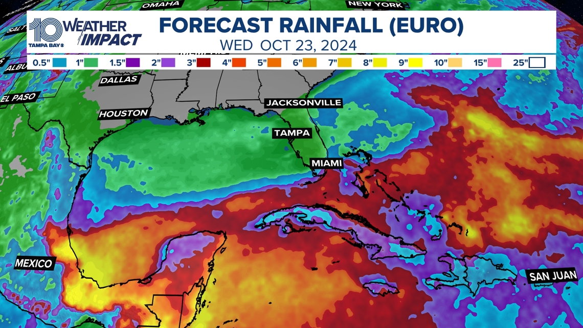
Rainfall over the next couple of weeks tells the story. Where you see the heavy rain would be the areas with a much higher risk of tropical activity. The main impact zone will shift to the Caribbean and south into Central America.
We will keep a close eye on things as always but it appears to be a much quieter pattern here at home. Some areas here at home may not see a drop of rain with our coolest weather since May on the way. Sweater weather and tropical weather do not mix. Lows even in Tampa falling to the 50s by Thursday morning.


We will continue to keep you informed, prepared and connected now and through the end of hurricane season.

