ST. PETERSBURG, Fla. — It's been feeling a lot like summer in Florida lately, and the forecast looks more of the same, just ahead of the official start to the season.
The summer solstice on Thursday marks the start of astronomical summer when the sun's direct rays appear directly over the Tropic of Cancer. This year, that's at 4:50 p.m. Eastern Time.
Tampa will have a sunrise at 6:34 a.m. and a sunset at 8:29 p.m. — a whopping 13 hours and 54 minutes of daylight, which allows our high sun angle in Tampa to go to work.
So, what does the rest of the summer have in store? We have an early look below.
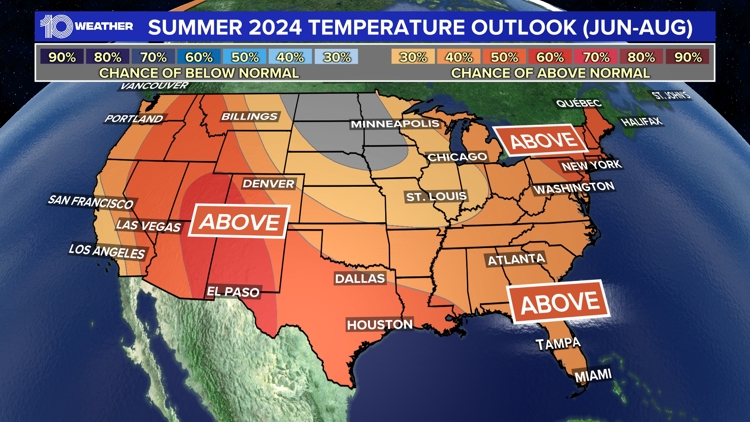
Florida summer temperature outlook


Last summer, the heat in Tampa was turned up a couple of notches. It was not just hot, but we had relentless heat without the typical cooling showers and thunderstorms.
Our rainy season was absent well into July as our wind came out of the opposite direction it normally does. This west wind kept the sea breeze storms focused on Florida's east coast. It produced the hottest summer on record for Sarasota-Bradenton, Lakeland and Plant City.
Tampa had an average temperature of a scorching 85.6 degrees. While temperatures are still expected to be above average, they will be closer to normal and not off the charts like last year.
Florida summer rainfall outlook

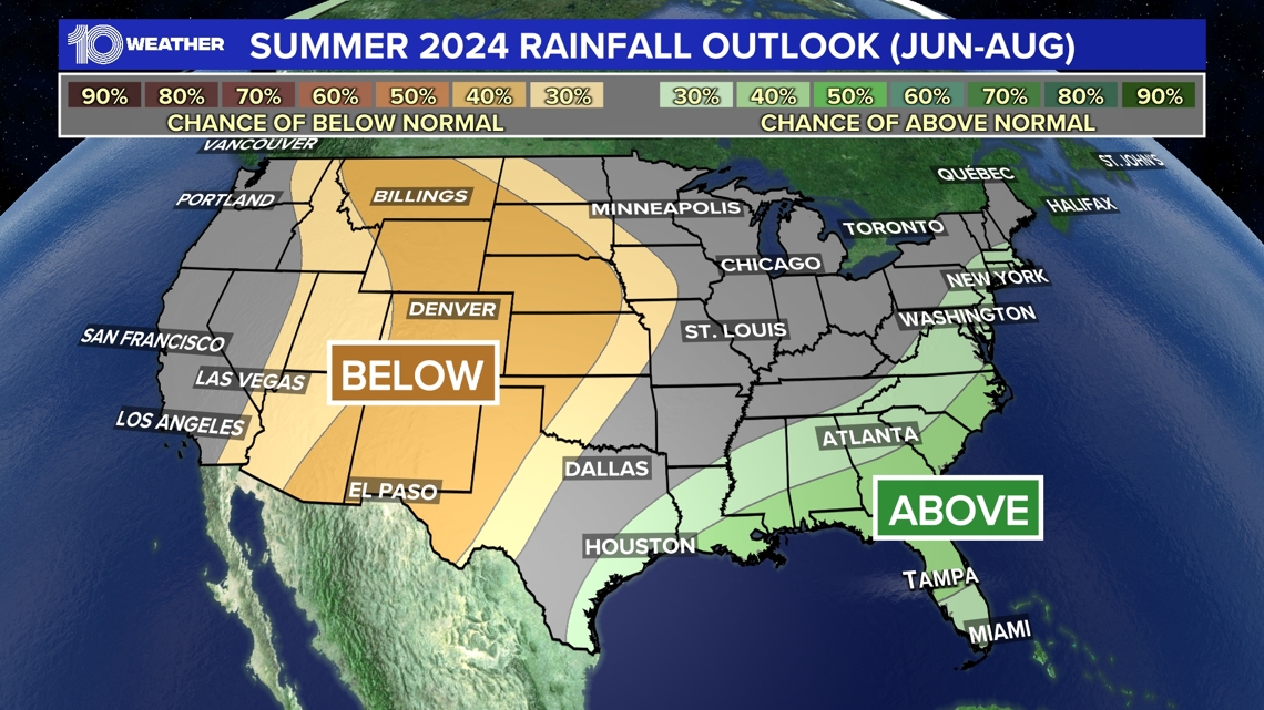
Notice Florida's rainfall forecast is also expected to be above average. This year, we can expect a much more typical thunderstorm season in the Tampa Bay area.
A high-pressure system centered farther south and east last year, bringing those hot and dry west winds, is now located farther north and west. This means sea-breeze collisions will return to Tampa Bay, and the unusually warm waters in the Atlantic and Gulf will have no problem fueling thunderstorms.
The new steering currents will also need to be watched carefully for a more active tropical season. This season may bring more tropical moisture our way, increasing our rainfall. Hopefully, that will come without any direct tropical impacts.