
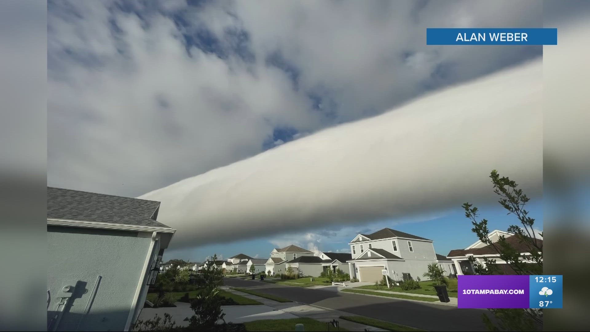
PARRISH, Fla. — This isn't something you see every day — a long, continuous, low-hanging cloud looming over a neighborhood in Parrish.
10 Tampa Bay viewer Alan Weber sent these in Friday morning, saying he's "never seen anything like it." Alan, a lot of us in the newsroom have never seen this either!
Chief Meteorologist Bobby Deskins recognized it immediately and let us know it's called a "roll cloud."
According to the National Weather Service, a roll cloud is a "low, horizontal tube-shaped arcus cloud associated with a thunderstorm gust front (or sometimes a cold front)."
The NWS goes on to explain that roll clouds are pretty rare. Additionally, they are "completely detached from a thunderstorm base or other cloud features." This makes them different from the more familiar shelf clouds (aka another type of arcus cloud).

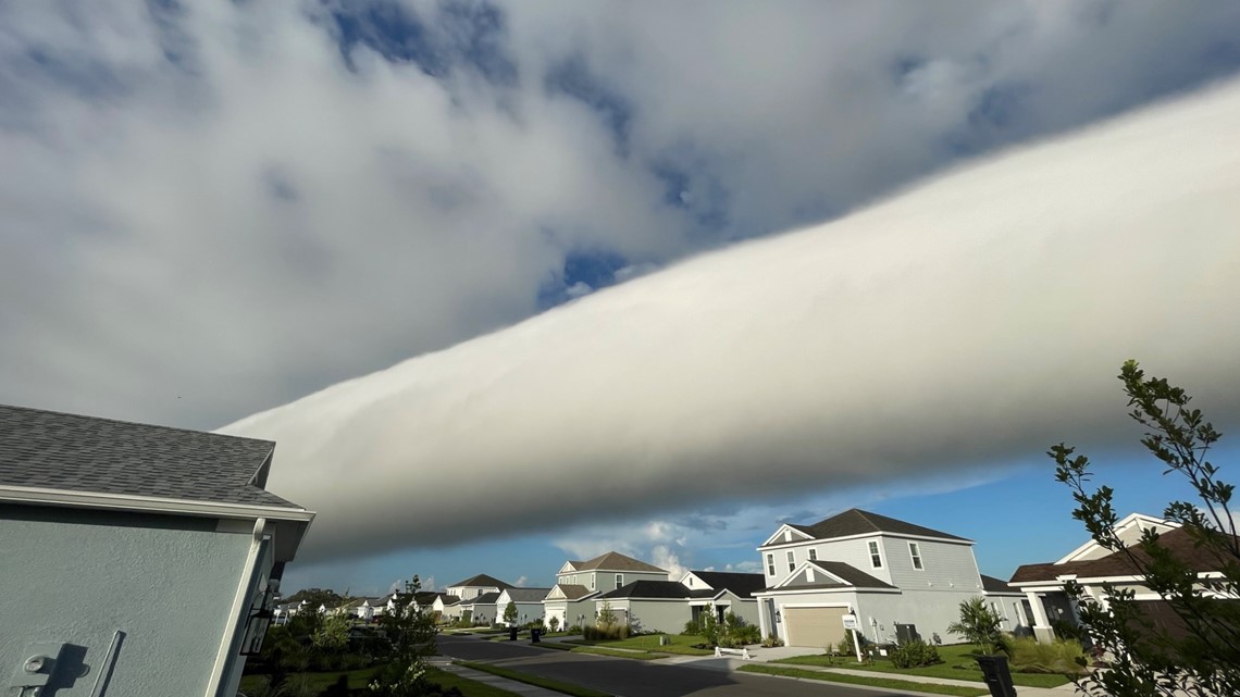
Not to be confused with funnel clouds, roll clouds typically look like they're "rolling" around on a horizontal axis.
Alan, thanks for sharing with the 10 Tampa Bay team!
Do you have any crazy or unique weather photos? See breaking news or something we should check out? Make sure to send them to 10 Tampa Bay using the "Near Me" section of our free 10 Tampa Bay app.