TAMPA, Fla. — As you step outside during the second half of this week, you'll notice a pretty significant drop in temperatures here in the Tampa Bay area. For some, it's a welcomed cooldown. For others, it's a cue to bundle up or even turn on the heat.
Our 10 Weather team has been tracking this cold front since last week.
The cooler air came in the wake of a cold front that moved Wednesday through the Tampa Bay area. For your Thursday morning, most of the area will see temperatures in the 50s. Some people on the Nature Coast may have even seen temperatures in the 40s when they woke up.
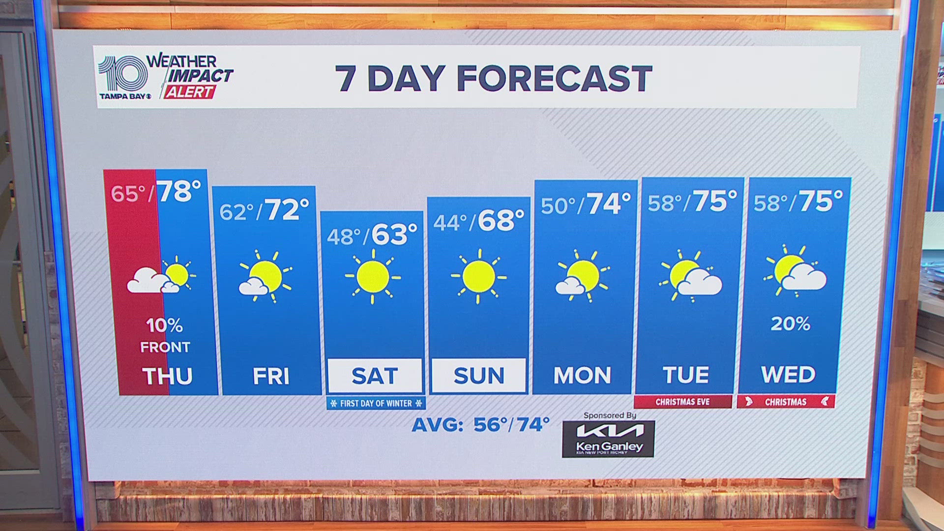
Thursday will be mostly sunny, helping to boost temperatures into the upper 60s during the afternoon. But those temperatures are about 10 degrees cooler than normal. And, it'll be a little breezy Thursday.

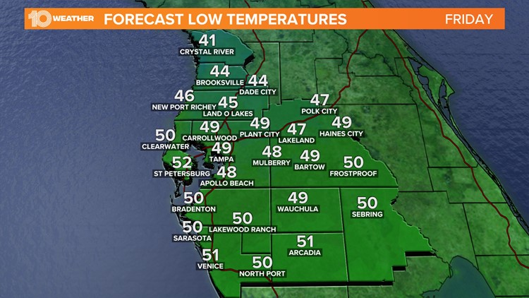
Your Thursday night will be even colder as temperatures cool into the upper 40s across most of the Tampa Bay area. Some inland areas north of Tampa Bay could see the thermometer sink into the upper 30s.

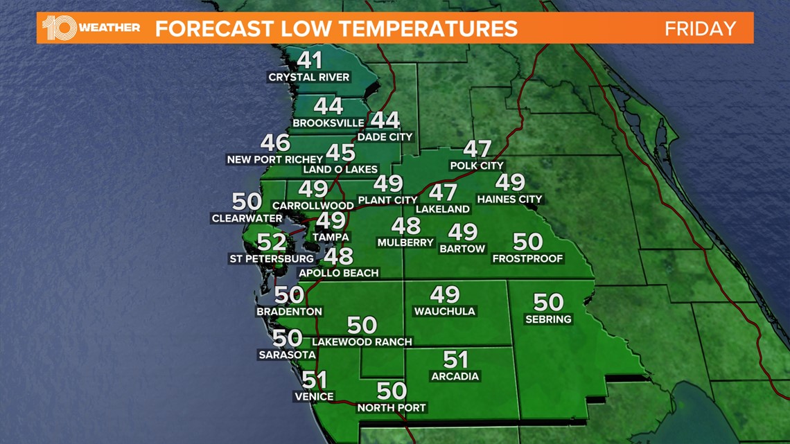
It wasn't that long ago when temperatures were this cool. On Oct. 20 the low temperature at Tampa International Airport was in the upper 40s. If the temperature Friday morning, however, drops to less than 49 degrees it will be the coldest morning in Tampa since March 13, 2022, when the low temperature was 41 degrees.

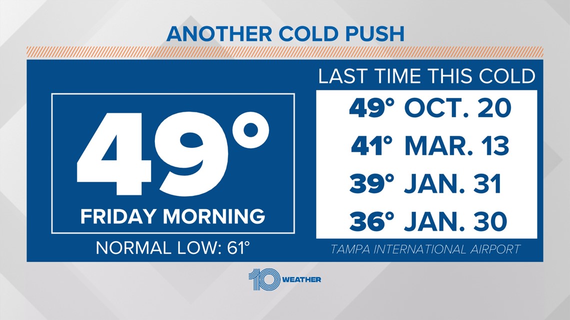
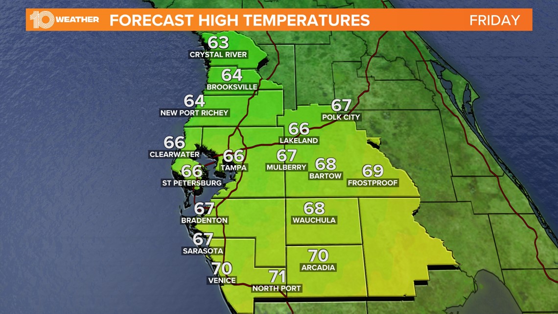
Friday will have a similar temperature range in the afternoon with highs in the mid-to-upper 60s. Sunny skies will also continue throughout the day to usher in the weekend.
While temperatures will try to sneak their way back into the 70s by Saturday, an area of low pressure to our west looks to be setting up over the weekend across the southern U.S., approaching the state by Sunday, bringing more clouds and rain chances our way. This combined with a stalled boundary to our south would also keep our temperatures down as we wrap up the weekend and go into next week.

