After a record-breaking fast start to the Atlantic hurricane season with the third, fifth and sixth named storms -- Cristobal, Edouard and Fay, respectively -- becoming the earliest storms by number for the basin, the tropics have been inactive since the demise of Fay last Saturday, July 11. However, it is not uncommon for the tropics to "take a break" during this time of the year in the Atlantic.
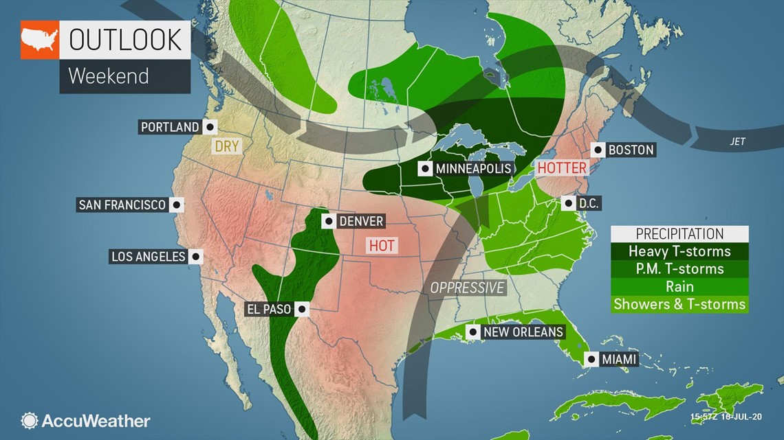
The main reason for this is the northward retreat of the jet stream. This prevents cold fronts from moving over the warm waters of the Gulf of Mexico and the western Atlantic Ocean. Oftentimes, areas of low pressure can develop along these fronts and foster development of tropical depressions and storms. This is precisely what gave birth to the formation of Tropical Storm Fay last week.
The location of the jet stream farther to the north combined with dry air, dust and wind shear across much of the Atlantic makes for an unfavorable environment for tropical development.
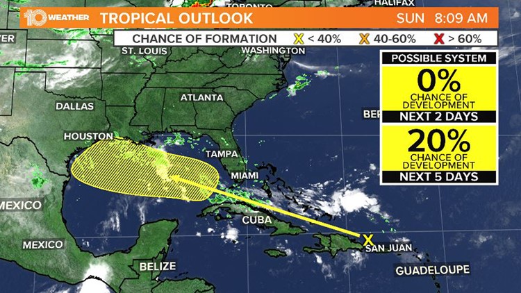
Despite the current lull, there are a few areas that AccuWeather meteorologists are keeping an eye on for potential trouble.
One area of focus is located over the area of the Atlantic Ocean west of Africa. In this part of the world, dozens of disturbances move off of the African continent and travel westward during every hurricane season. While most of these disturbances do not develop, a few can become better organized and some eventually develop into tropical depressions, storms, and even powerful hurricanes.
A few such waves are traversing the central Atlantic Ocean at this time. However, given the extensive hostile conditions, none of these waves are forecast to develop over at least the next several days.
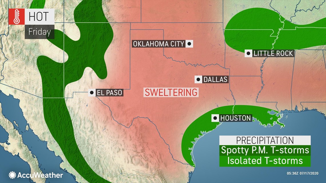
In the Gulf of Mexico, the leftover part of an old complex of thunderstorms was moving westward just offshore of the western Louisiana and southeastern Texas coast on Friday morning. This area, too, is unlikely to develop.


"Proximity to the coast and the disturbance's very weak state will probably not allow enough time for development before pushing onshore in Texas Friday night or Saturday," AccuWeather Senior Meteorologist Rob Miller said.


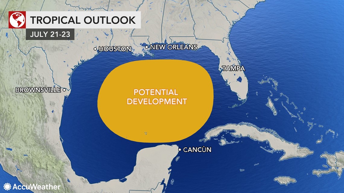
While this area of showers and thunderstorms is not forecast to develop into a tropical depression or tropical storm, there is expected to be an increase in the coverage of showers and thunderstorms over the Gulf of Mexico next week. However, there will still be obstacles to overcome for potential tropical development.


"Factors for some slow development are an increase in moisture over the Gulf and the warm water next week," Miller said, with water temperatures in the mid to upper 80s.
Typically, tropical systems develop when water temperatures are at or above 80 degrees.
"But wind shear may be too strong to allow a tropical system to develop and catch on," Miller continued.
The Gulf of Mexico is not a common breeding ground for tropical systems in the middle of July.
"Only four tropical systems have developed during the stretch from July 11 to 20 in the Gulf of Mexico over the last 170 years," AccuWeather Senior Meteorologist Mike Doll said.
The next tropical storm that forms in the Atlantic will take the name Gonzalo.
Despite only a very low potential for development in the near future, AccuWeather is still forecasting a busy season, with 14-20 named tropical storms, seven to 11 hurricanes and four to six major hurricanes -- Category 3 or higher.


