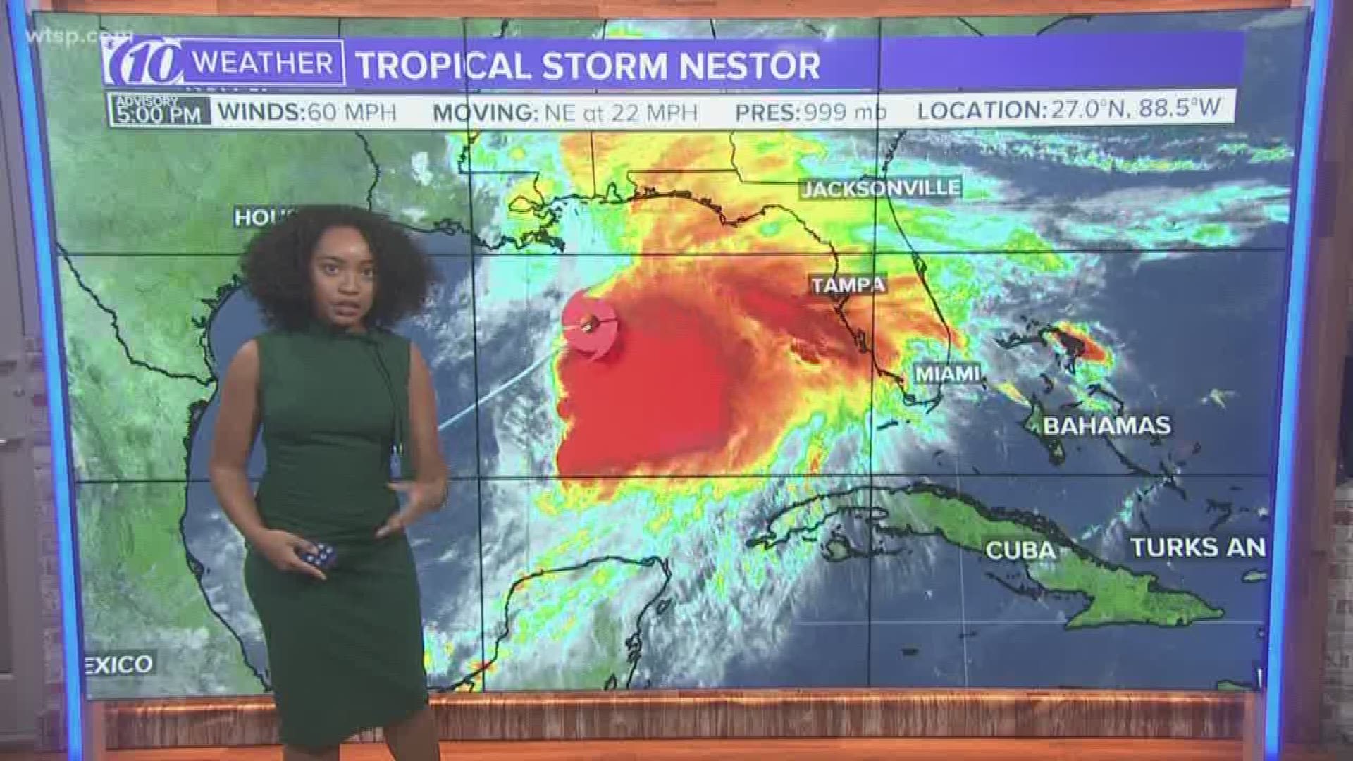
So the timing is never good for a tropical storm; but unfortunately, Tropical Storm Nestor is moving into Florida just in time for the weekend. While the weekend isn't a washout, tonight through tomorrow will be a great time to make some inside plans. Some will even be on alert. Here's exactly everything you need to know.
- There will be impacts for Tampa Bay: Nestor is unlikely to become a hurricane, but even as a tropical storm that makes landfall in the panhandle, storm surge with strong, gusty winds and big waves can be expected.
- Storm surge: From about Clearwater Beach and points north, 2-4’ of storm surge will be possible. In fact, storm surge of 1 to 3 feet is LIKELY to occur in portions of Tampa Bay. This may cause some localized flooding, especially during the high tides. Check the high tide times for your area.
- Coast flooding: The strong winds will cause some coastal flooding along many of our beaches but also around the bay into Tampa. In fact, a coastal flood advisory is in effect for Hillsborough County for this reason.
- Big waves: High surf advisories are in effect as waves are expected to reach 5-7 feet as the strongest winds arrive early Saturday morning. A High Surf Advisory means that high surf will affect beaches in the advisory area, producing localized beach erosion and dangerous swimming conditions.
- Rip current risk: Swimming is risky in wind like this as wind-driven surf and increasing wave action will create dangerous rip currents. These strong rip currents will create unsafe swimming conditions at area beaches.
- Gusty winds: Our winds will be breezy to, at times, windy. Overnight tonight and much of Saturday will see winds out of the south and eventually southwest blowing 20+ mph, gusting at times over 30 mph. Coastal areas could see winds gust higher.
- Rain: Friday night and Saturday will not be a great day for outdoor activities. Waves of showers and a few thunderstorms will be found. One to three inches of rain can be expected. Nothing we don’t see from summertime storms, but very wet nonetheless. After a few morning rain chances on Sunday, most of Sunday looks great with sunshine returning and a high in the mid-80s.
- Tornadoes: Tornadoes are often spawned on the right-hand side of landfalling tropical storms and hurricanes. With the position of this tropical storm, we have an environment that is slightly favorable for a tornado or waterspout to develop. Severe weather could begin as soon as Friday evening as Nestor is approaching our region.
- Timing: The weather is starting to go downhill a bit this evening, with areas of heavy rain and lightning lurking just off the coast. The winds pick up overnight and tomorrow morning. By Saturday evening, the winds greatly diminish. The heavier rain areas all move northeast as well.
- What if you don’t live near the water? You’ll mainly see wind and rain. General flooding isn’t expected. Watch for an isolated strong thunderstorm. Remember, we do have a small tornado risk.
Related Coverage:
FREE 10NEWS APP:


