TAMPA, Fla. — As hurricane season becomes more active, storm forecasters are using a new tool to try to improve our ability to forecast a storm’s intensity.
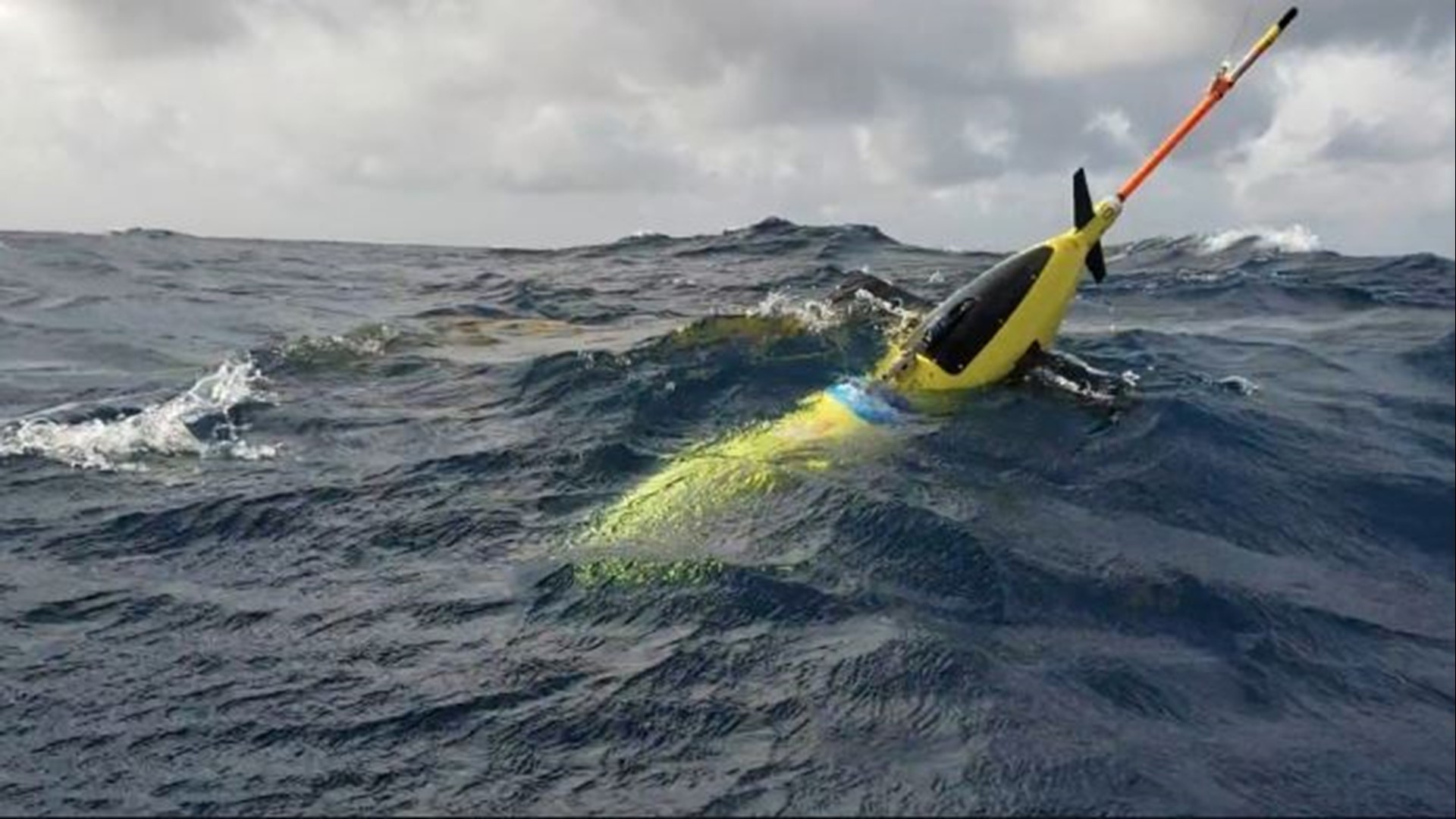
A fleet of small submarines called ocean gliders could improve our ability to not only predict a hurricane’s path but how strong it’s likely to become.
Thanks to satellite technology, hurricane hunters and a system of buoys at sea, forecasters have gotten a lot better at plotting a storm’s path.
Now, scientists with the University of Miami in cooperation with NOAA and several other agencies hope "Ocean Gliders" can take things a step further.
The glider would take measurements of water temperature, salt content and oxygen levels hundreds of meters below the surface to help better predict a storm’s intensity, or how strong it’s likely to become.
“So, we suspect that by assimilating the glider profiles collected in the Caribbean Sea into the model will improve the five-day intensity forecast,” NOAA Scientist Sang-Ki Lee said.
The gliders have been deployed in strategic locations where storms usually travel.
Each one has a buoyancy system and a pump so they can remotely control its depth and movement.
“And the glider users, then, predetermined compass targets with these movements to help navigate to water and maintain its course over long periods of time,” NOAA Scientist Diego Ugaz said.
Being out in the middle of the ocean for up to ten months at a time, some of the gliders have had an occasional run-in with wildlife.
“We had one documented case where we’ve recovered a glider with a shark tooth stuck inside it,” Ugaz said. “So, we can confirm that the glider was sought after as prey and a shark took a bite out of it only to realize it made a mistake and left it alone after that.”
Gliders are capable of diving to a depth of 1000 meters or 3300 feet. But it usually gathers storm data at about half that depth.
Over the course of time, scientists have looked for correlations between the data sent back by the gliders and what storms have ultimately done, and they believe they’re now ready to add what they observe below the surface to what we can see from above.
“We feel like the modeling systems are to the point where they can make use of that data. The resolution is fine enough that we can properly include those in the prediction,” NOAA Scientist Mark DeMaria said. “So, having access to this new data source is going to be very important for us going forward into the future to make our forecast even better.”
Scientists hope that the more accurate they can be forecasting the intensity of storms the more trust people will have in evacuation warnings when they are issued.
What other people are reading right now:
- Body of missing 5-year-old found in Highlands County lake
- Universal Orlando cancels Holloween Horror Nights
- Opening Day tweet from the Rays calls for the arrests of Breonna Taylor's killers
- Longtime Rep. Buchanan staffer dies from COVID-19
- Florida passes 400,000 confirmed cases of COVID-19
- Hillsborough County Schools reopening delayed by 2 weeks to Aug. 24
- Trump cancels Jacksonville segment of Republican National Convention
- Here are the reopening plans for Tampa Bay school districts

