

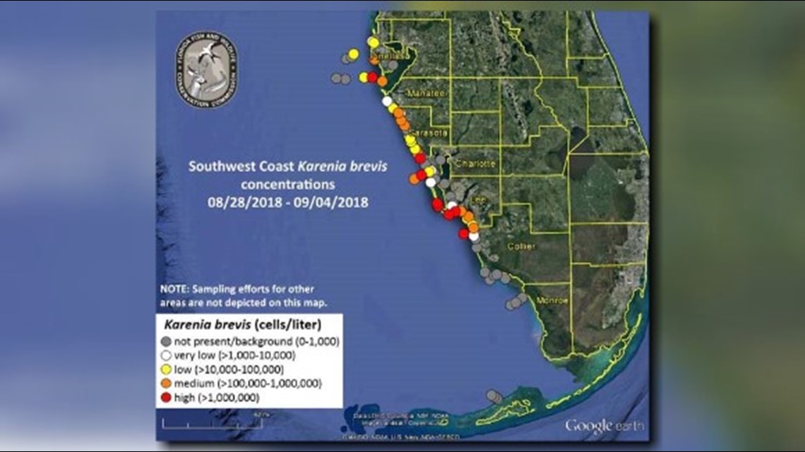
Florida's red tide bloom has decreased slightly in length.
Previously extending along roughly 145 miles of coastline, the Florida Fish and Wildlife Conservation Commission says the bloom of Karenia brevis now extends along only 120 miles.
High concentrations of the state's red tide organism were reported in or offshore of Hillsborough, Charlotte, Lee and Collier counties, according to the Wednesday update from FWC. However, high concentrations were not reported in Pinellas, Manatee or Sarasota counties.
Red tide concentrations have decreased in parts of Sarasota and Collier counties.
FWC officials say it's too early to say if Tropical Storm Gordon lowered the concentrations of red tide near shore. But, they're trying to figure that out.
The FWC forecasts surface water movement will push the red tide bloom slightly to the northwest over the next three days.
View the latest red tide map below. If you are having trouble viewing the map, click here.
►Make it easy to keep up-to-date with more stories like this. Download the 10News app now.
Have a news tip? Email desk@wtsp.com, or visit our Facebook page or Twitter feed.