/![635735200104922324-pascoevacmap [ID=30701881]](http://cdn.tegna-tv.com/-mm-/d833a91bcc2f2b659f41d5b59a1c9349b476b501/r=500x321/local/-/media/2015/07/26/WTSP/WTSP/635735200104922324-pascoevacmap.JPG)
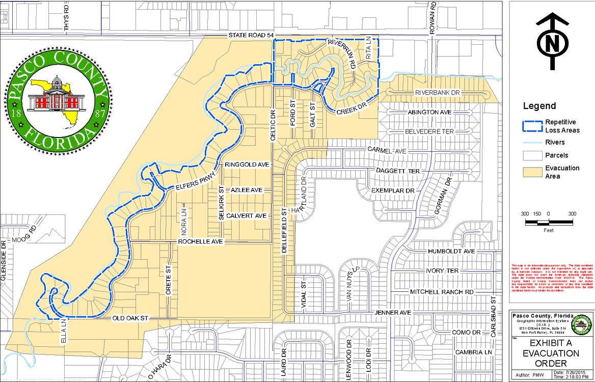
Recent flooding is threatening area homes on Elfers Parkway and Celtic Drive after the river has risen to a height of 23.47 feet. The river is forecasted to rise to 24.5 feet by 8 p.m. Sunday night.
At 24 feet, the area is considered to be in a major flood stage.
Pasco County Sheriff's Office announced on Twitter that it is a Mandatory Evacuation Notice.
The evacuation area spans from Ella Lane north to State Road 54 and from Dellefield Street and Riverbank Drive west to Glenside Drive.
A flood shelter has been opened by the American Red Cross at First Presbyterian Church of Port Richey at 7540 Ridge Road, Port Richey. Transportation for residents who need assistance will take place at the Bealls Outlet Store at 7101 State Road 54 in New Port Richey.
Heavy rains have typically threatened this area. Previous storms like Tropical Storm Debby and Tropical Storm Issac have inundated the New Port Richey area.
RELATED STORIES:


