
TAMPA, Florida — As the odds increase for possible tropical development in the Caribbean and Gulf, first responders are once again encouraging residents to have a plan and to know their evacuation zones.
The Tampa Bay area is prone to the effects of storm surges due to its geographical location but also low-lying areas and sources of water inland.
Before a threat could come to fruition, first responders said now is the time to prepare especially with another disaster preparedness sales tax holiday starting Saturday.
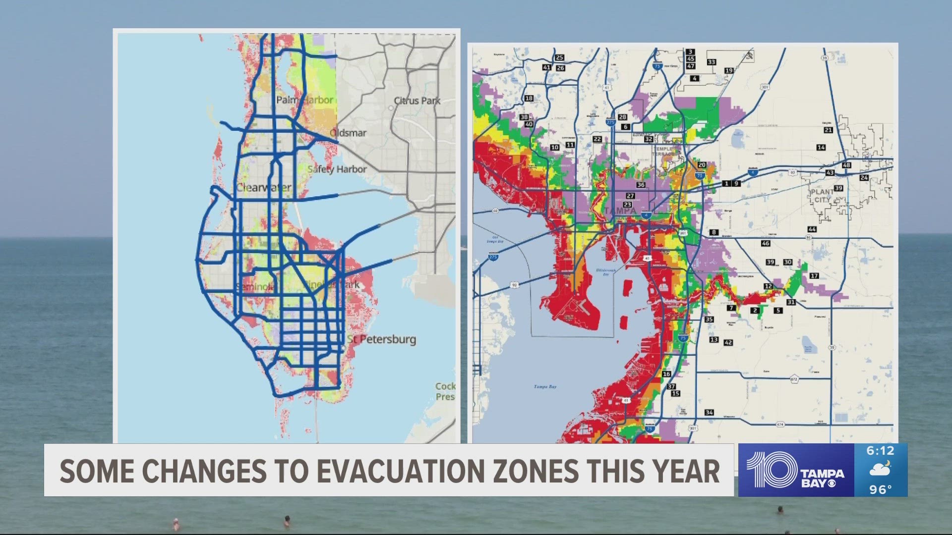
Some evacuation zones have changed in recent years.
For instance, parts of East Tampa are now in Evacuation Zone E, the last to be called. However, it's surrounded by zones more at risk.
"Our goal is not to scare people. Our goal is to save lives," Pinellas County Public Information Officer Dave Connor said. "We ask that residents continue to heed those evacuation orders.
"Stay informed, have your plan ready so you know where to go and if that order comes, it's the best thing for you and your family and your pets to listen to it."
In addition, Pinellas County saw at least 34,000 properties at higher risk, according to Connor.
That could mean one area was moved from Zone B to Zone A, the first evacuation zone ordered.
A 2022 analysis also found more areas of greater risk including Seminole, Oldsmar, Tarpon Springs, Gulfport and part of North St. Pete off 4th Street North.
The Florida Division of Emergency Management has a map for each county posted on its website, showing generalized evacuation zones and accessible routes.
Remember, these maps are posted as a reference. Any specific evacuation order is issued by local emergency managers.
The two biggest evacuation routes, if necessary, are Interstate 75 north to the Georgia state line and I-4 east into Orlando. In some extreme evacuation situations, the highways will go into "contraflow," meaning traffic in all lanes moves in the same direction.